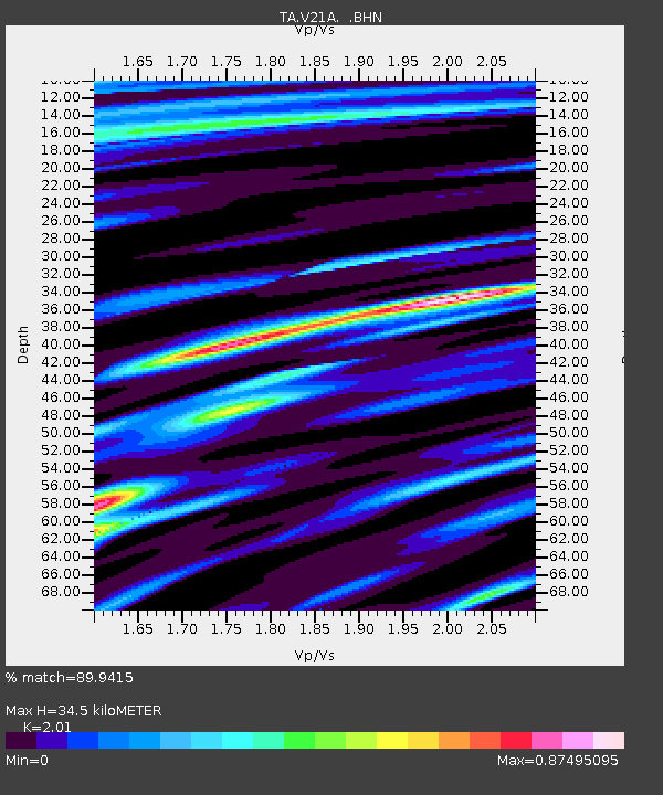
V21A Milan, NM, USA - Earthquake Result Viewer
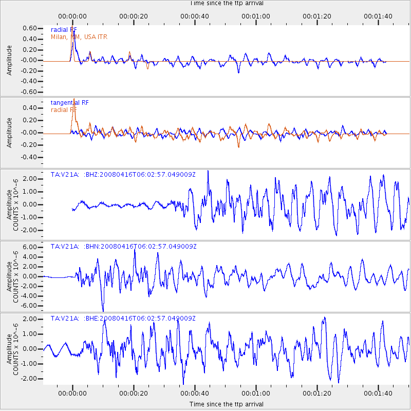
Earthquake location: Andreanof Islands, Aleutian Is.
Earthquake latitude/longitude: 51.9/-179.2
Earthquake time(UTC): 2008/04/16 (107) 05:54:19 GMT
Earthquake Depth: 13 km
Earthquake Magnitude: 6.1 MB, 6.5 MS, 6.6 MW, 6.6 MW
Earthquake Catalog/Contributor: WHDF/NEIC
Network: TA USArray Transportable Network (new EarthScope stations)
Station: V21A Milan, NM, USA
Lat/Lon: 35.81 N/107.64 W
Elevation: 2046 m
Distance: 51.9 deg
Az: 78.35 deg
Baz: 311.677 deg
Ray Param: 0.06708544
Estimated Moho Depth: 34.5 km
Estimated Crust Vp/Vs: 2.01
Assumed Crust Vp: 6.502 km/s
Estimated Crust Vs: 3.235 km/s
Estimated Crust Poisson's Ratio: 0.34
Radial Match: 89.9415 %
Radial Bump: 400
Transverse Match: 76.594894 %
Transverse Bump: 400
SOD ConfigId: 2504
Insert Time: 2010-03-06 19:06:43.100 +0000
GWidth: 2.5
Max Bumps: 400
Tol: 0.001

Signal To Noise

ChannelStoNSTALTA
TA:V21A: :BHN:20080416T06:02:57.049009Z3.615077.9140125E-72.1891726E-7
TA:V21A: :BHE:20080416T06:02:57.049009Z1.6627843.2385663E-71.9476772E-7
TA:V21A: :BHZ:20080416T06:02:57.049009Z1.29330661.8622481E-71.4399123E-7
Arrivals
Ps5.6 SECOND
PpPs15 SECOND
PsPs/PpSs21 SECOND