You are here: Home > Network List > TA - USArray Transportable Network (new EarthScope stations) Stations List
> Station 121A Cookes Peak, Deming, NM, USA > Earthquake Result Viewer
121A Cookes Peak, Deming, NM, USA - Earthquake Result Viewer
*The percent match for this event was below the threshold and hence no stack was calculated.
| Earthquake location: |
Alaska Peninsula |
| Earthquake latitude/longitude: |
54.3/-161.4 |
| Earthquake time(UTC): |
2018/12/31 (365) 02:35:38 GMT |
| Earthquake Depth: |
34 km |
| Earthquake Magnitude: |
5.8 Mi |
| Earthquake Catalog/Contributor: |
NEIC PDE/at |
|
| Network: |
TA USArray Transportable Network (new EarthScope stations) |
| Station: |
121A Cookes Peak, Deming, NM, USA |
| Lat/Lon: |
32.53 N/107.79 W |
| Elevation: |
1652 m |
|
| Distance: |
43.3 deg |
| Az: |
97.672 deg |
| Baz: |
316.505 deg |
| Ray Param: |
$rayparam |
*The percent match for this event was below the threshold and hence was not used in the summary stack. |
|
| Radial Match: |
62.572025 % |
| Radial Bump: |
400 |
| Transverse Match: |
51.74575 % |
| Transverse Bump: |
400 |
| SOD ConfigId: |
13570011 |
| Insert Time: |
2019-05-02 05:42:48.319 +0000 |
| GWidth: |
2.5 |
| Max Bumps: |
400 |
| Tol: |
0.001 |
|
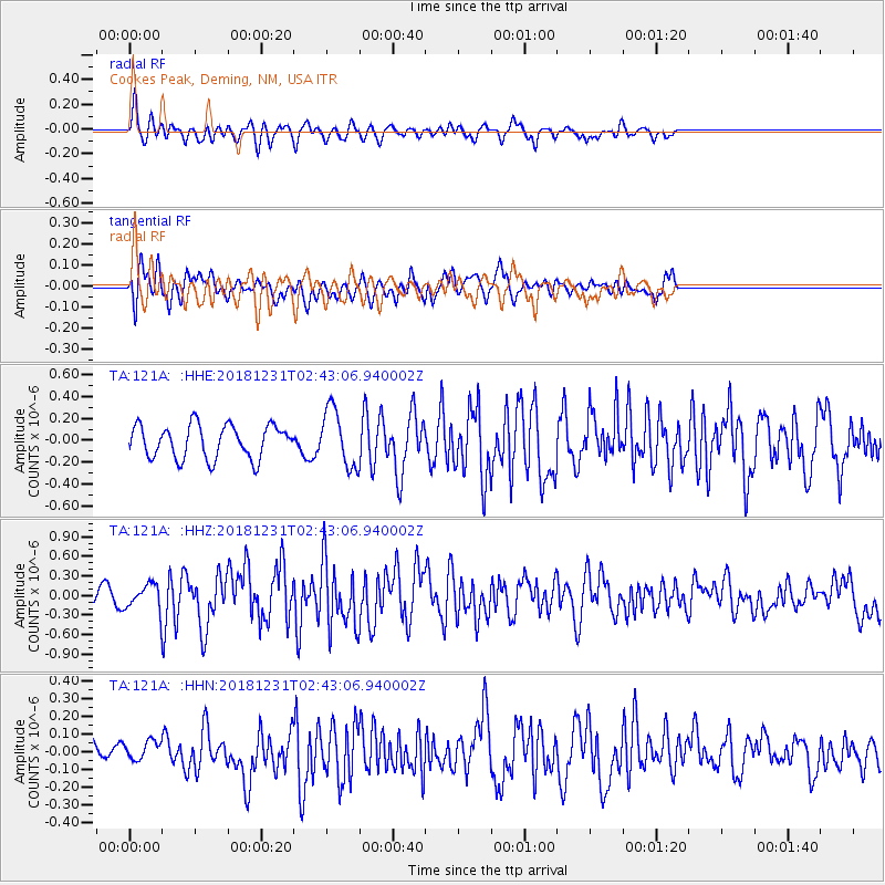
Signal To Noise
| Channel | StoN | STA | LTA |
| TA:121A: :HHZ:20181231T02:43:06.940002Z | 1.2145598 | 1.9406427E-7 | 1.5978158E-7 |
| TA:121A: :HHN:20181231T02:43:06.940002Z | 0.63607866 | 5.366058E-8 | 8.4361545E-8 |
| TA:121A: :HHE:20181231T02:43:06.940002Z | 1.6254444 | 2.4754326E-7 | 1.5229267E-7 |
| Arrivals |
| Ps | |
| PpPs | |
| PsPs/PpSs | |


