You are here: Home > Network List > TJ - Tajikistan National Seismic Network Stations List
> Station GARM Garm, Tajikistan > Earthquake Result Viewer
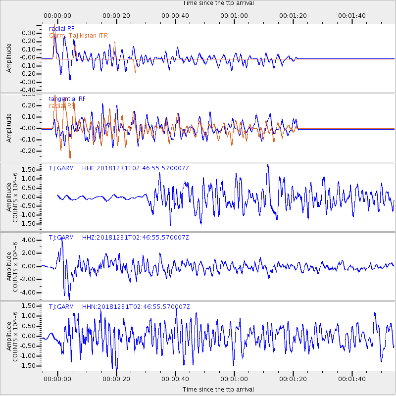
GARM Garm, Tajikistan - Earthquake Result Viewer
*The percent match for this event was below the threshold and hence no stack was calculated.
| Earthquake location: |
Alaska Peninsula |
| Earthquake latitude/longitude: |
54.3/-161.4 |
| Earthquake time(UTC): |
2018/12/31 (365) 02:35:38 GMT |
| Earthquake Depth: |
34 km |
| Earthquake Magnitude: |
5.8 Mi |
| Earthquake Catalog/Contributor: |
NEIC PDE/at |
|
| Network: |
TJ Tajikistan National Seismic Network |
| Station: |
GARM Garm, Tajikistan |
| Lat/Lon: |
39.00 N/70.32 E |
| Elevation: |
1305 m |
|
| Distance: |
77.0 deg |
| Az: |
321.111 deg |
| Baz: |
28.209 deg |
| Ray Param: |
$rayparam |
*The percent match for this event was below the threshold and hence was not used in the summary stack. |
|
| Radial Match: |
73.98968 % |
| Radial Bump: |
400 |
| Transverse Match: |
79.50179 % |
| Transverse Bump: |
381 |
| SOD ConfigId: |
13570011 |
| Insert Time: |
2019-05-02 05:42:59.198 +0000 |
| GWidth: |
2.5 |
| Max Bumps: |
400 |
| Tol: |
0.001 |
|
Signal To Noise
| Channel | StoN | STA | LTA |
| TJ:GARM: :HHZ:20181231T02:46:55.570007Z | 11.985103 | 2.5457437E-6 | 2.12409E-7 |
| TJ:GARM: :HHN:20181231T02:46:55.570007Z | 3.2530706 | 4.7116242E-7 | 1.4483622E-7 |
| TJ:GARM: :HHE:20181231T02:46:55.570007Z | 7.1035786 | 5.5231817E-7 | 7.7752105E-8 |
| Arrivals |
| Ps | |
| PpPs | |
| PsPs/PpSs | |


