You are here: Home > Network List > TA - USArray Transportable Network (new EarthScope stations) Stations List
> Station 121A Cookes Peak, Deming, NM, USA > Earthquake Result Viewer
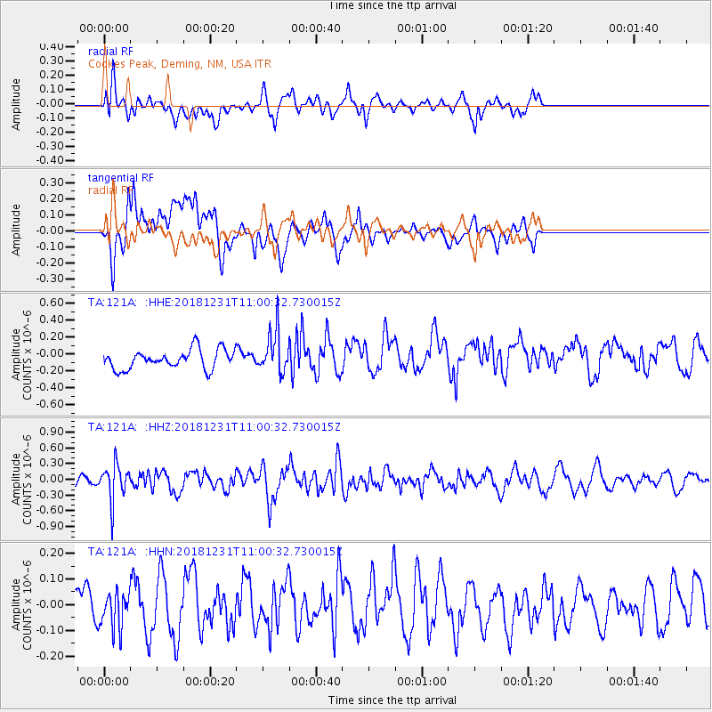
121A Cookes Peak, Deming, NM, USA - Earthquake Result Viewer
*The percent match for this event was below the threshold and hence no stack was calculated.
| Earthquake location: |
San Juan Province, Argentina |
| Earthquake latitude/longitude: |
-31.8/-69.3 |
| Earthquake time(UTC): |
2018/12/31 (365) 10:49:41 GMT |
| Earthquake Depth: |
101 km |
| Earthquake Magnitude: |
5.3 Mww |
| Earthquake Catalog/Contributor: |
NEIC PDE/us |
|
| Network: |
TA USArray Transportable Network (new EarthScope stations) |
| Station: |
121A Cookes Peak, Deming, NM, USA |
| Lat/Lon: |
32.53 N/107.79 W |
| Elevation: |
1652 m |
|
| Distance: |
73.6 deg |
| Az: |
326.772 deg |
| Baz: |
146.458 deg |
| Ray Param: |
$rayparam |
*The percent match for this event was below the threshold and hence was not used in the summary stack. |
|
| Radial Match: |
58.085236 % |
| Radial Bump: |
400 |
| Transverse Match: |
58.677986 % |
| Transverse Bump: |
400 |
| SOD ConfigId: |
13570011 |
| Insert Time: |
2019-05-02 05:49:54.905 +0000 |
| GWidth: |
2.5 |
| Max Bumps: |
400 |
| Tol: |
0.001 |
|
Signal To Noise
| Channel | StoN | STA | LTA |
| TA:121A: :HHZ:20181231T11:00:32.730015Z | 3.215566 | 3.410985E-7 | 1.0607729E-7 |
| TA:121A: :HHN:20181231T11:00:32.730015Z | 0.6830802 | 6.81323E-8 | 9.9742756E-8 |
| TA:121A: :HHE:20181231T11:00:32.730015Z | 2.1506927 | 2.417658E-7 | 1.1241299E-7 |
| Arrivals |
| Ps | |
| PpPs | |
| PsPs/PpSs | |


