You are here: Home > Network List > TA - USArray Transportable Network (new EarthScope stations) Stations List
> Station A21K Barrow, AK, USA > Earthquake Result Viewer
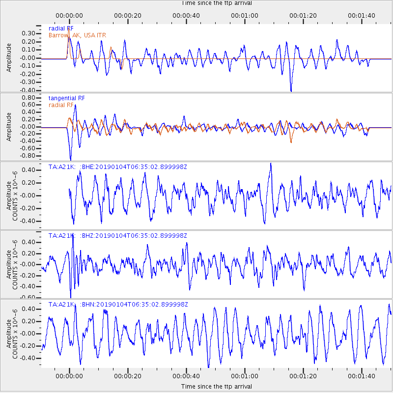
A21K Barrow, AK, USA - Earthquake Result Viewer
*The percent match for this event was below the threshold and hence no stack was calculated.
| Earthquake location: |
Banda Sea |
| Earthquake latitude/longitude: |
-6.5/130.4 |
| Earthquake time(UTC): |
2019/01/04 (004) 06:22:44 GMT |
| Earthquake Depth: |
118 km |
| Earthquake Magnitude: |
5.6 Mww |
| Earthquake Catalog/Contributor: |
NEIC PDE/us |
|
| Network: |
TA USArray Transportable Network (new EarthScope stations) |
| Station: |
A21K Barrow, AK, USA |
| Lat/Lon: |
71.32 N/156.62 W |
| Elevation: |
577 m |
|
| Distance: |
90.7 deg |
| Az: |
17.946 deg |
| Baz: |
251.85 deg |
| Ray Param: |
$rayparam |
*The percent match for this event was below the threshold and hence was not used in the summary stack. |
|
| Radial Match: |
43.736256 % |
| Radial Bump: |
400 |
| Transverse Match: |
64.95096 % |
| Transverse Bump: |
400 |
| SOD ConfigId: |
13570011 |
| Insert Time: |
2019-05-02 05:54:46.907 +0000 |
| GWidth: |
2.5 |
| Max Bumps: |
400 |
| Tol: |
0.001 |
|
Signal To Noise
| Channel | StoN | STA | LTA |
| TA:A21K: :BHZ:20190104T06:35:02.899998Z | 2.5758278 | 2.7002451E-7 | 1.0483019E-7 |
| TA:A21K: :BHN:20190104T06:35:02.899998Z | 1.3479824 | 2.4494986E-7 | 1.817159E-7 |
| TA:A21K: :BHE:20190104T06:35:02.899998Z | 0.8576338 | 1.6659722E-7 | 1.9425215E-7 |
| Arrivals |
| Ps | |
| PpPs | |
| PsPs/PpSs | |


