You are here: Home > Network List > TA - USArray Transportable Network (new EarthScope stations) Stations List
> Station V21A Milan, NM, USA > Earthquake Result Viewer
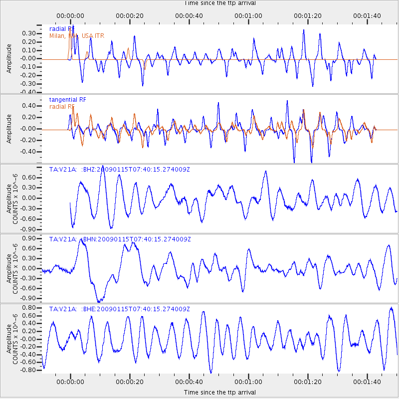
V21A Milan, NM, USA - Earthquake Result Viewer
*The percent match for this event was below the threshold and hence no stack was calculated.
| Earthquake location: |
Southeast Of Loyalty Islands |
| Earthquake latitude/longitude: |
-22.4/170.6 |
| Earthquake time(UTC): |
2009/01/15 (015) 07:27:20 GMT |
| Earthquake Depth: |
27 km |
| Earthquake Magnitude: |
5.8 MB, 6.5 MS, 6.7 MW, 6.6 MW |
| Earthquake Catalog/Contributor: |
WHDF/NEIC |
|
| Network: |
TA USArray Transportable Network (new EarthScope stations) |
| Station: |
V21A Milan, NM, USA |
| Lat/Lon: |
35.81 N/107.64 W |
| Elevation: |
2046 m |
|
| Distance: |
96.4 deg |
| Az: |
54.047 deg |
| Baz: |
247.209 deg |
| Ray Param: |
$rayparam |
*The percent match for this event was below the threshold and hence was not used in the summary stack. |
|
| Radial Match: |
68.55627 % |
| Radial Bump: |
400 |
| Transverse Match: |
73.478226 % |
| Transverse Bump: |
319 |
| SOD ConfigId: |
2834 |
| Insert Time: |
2010-03-06 19:09:14.385 +0000 |
| GWidth: |
2.5 |
| Max Bumps: |
400 |
| Tol: |
0.001 |
|
Signal To Noise
| Channel | StoN | STA | LTA |
| TA:V21A: :BHN:20090115T07:40:15.274009Z | 3.1020572 | 5.268165E-7 | 1.698281E-7 |
| TA:V21A: :BHE:20090115T07:40:15.274009Z | 0.38423365 | 1.7169849E-7 | 4.468596E-7 |
| TA:V21A: :BHZ:20090115T07:40:15.274009Z | 0.5686484 | 2.64217E-7 | 4.6464032E-7 |
| Arrivals |
| Ps | |
| PpPs | |
| PsPs/PpSs | |


