You are here: Home > Network List > TS - TERRAscope (Southern California Seismic Network) Stations List
> Station CALB Calabasas, California, USA > Earthquake Result Viewer
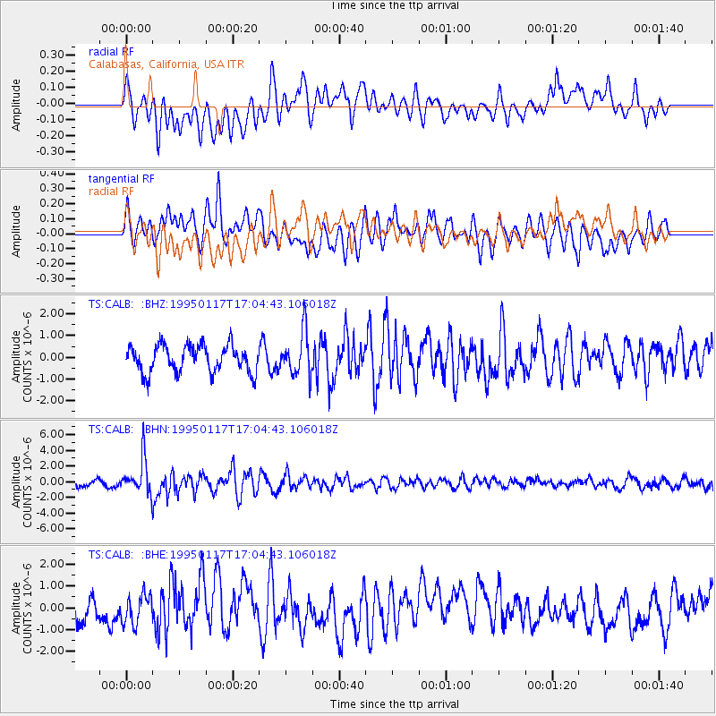
CALB Calabasas, California, USA - Earthquake Result Viewer
*The percent match for this event was below the threshold and hence no stack was calculated.
| Earthquake location: |
Fiji Islands Region |
| Earthquake latitude/longitude: |
-20.9/-179.2 |
| Earthquake time(UTC): |
1995/01/17 (017) 16:54:12 GMT |
| Earthquake Depth: |
637 km |
| Earthquake Magnitude: |
6.0 MB, 6.2 UNKNOWN, 6.4 MW |
| Earthquake Catalog/Contributor: |
WHDF/NEIC |
|
| Network: |
TS TERRAscope (Southern California Seismic Network) |
| Station: |
CALB Calabasas, California, USA |
| Lat/Lon: |
34.14 N/118.63 W |
| Elevation: |
0.0 m |
|
| Distance: |
79.5 deg |
| Az: |
47.304 deg |
| Baz: |
235.967 deg |
| Ray Param: |
$rayparam |
*The percent match for this event was below the threshold and hence was not used in the summary stack. |
|
| Radial Match: |
61.583817 % |
| Radial Bump: |
400 |
| Transverse Match: |
52.44058 % |
| Transverse Bump: |
400 |
| SOD ConfigId: |
4480 |
| Insert Time: |
2010-02-26 14:03:17.718 +0000 |
| GWidth: |
2.5 |
| Max Bumps: |
400 |
| Tol: |
0.001 |
|
Signal To Noise
| Channel | StoN | STA | LTA |
| TS:CALB: :BHN:19950117T17:04:43.106018Z | 5.3145757 | 2.1948608E-6 | 4.1298892E-7 |
| TS:CALB: :BHE:19950117T17:04:43.106018Z | 1.6532818 | 6.7721896E-7 | 4.09621E-7 |
| TS:CALB: :BHZ:19950117T17:04:43.106018Z | 1.6202636 | 1.014881E-6 | 6.263678E-7 |
| Arrivals |
| Ps | |
| PpPs | |
| PsPs/PpSs | |


