You are here: Home > Network List > TA - USArray Transportable Network (new EarthScope stations) Stations List
> Station L44A Lake County Forest Preserve, Grayslake, IL, USA > Earthquake Result Viewer
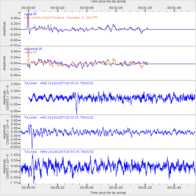
L44A Lake County Forest Preserve, Grayslake, IL, USA - Earthquake Result Viewer
*The percent match for this event was below the threshold and hence no stack was calculated.
| Earthquake location: |
Andreanof Islands, Aleutian Is. |
| Earthquake latitude/longitude: |
51.0/-178.2 |
| Earthquake time(UTC): |
2019/01/05 (005) 18:47:11 GMT |
| Earthquake Depth: |
35 km |
| Earthquake Magnitude: |
6.0 Mi |
| Earthquake Catalog/Contributor: |
NEIC PDE/at |
|
| Network: |
TA USArray Transportable Network (new EarthScope stations) |
| Station: |
L44A Lake County Forest Preserve, Grayslake, IL, USA |
| Lat/Lon: |
42.18 N/87.91 W |
| Elevation: |
202 m |
|
| Distance: |
59.0 deg |
| Az: |
60.17 deg |
| Baz: |
312.458 deg |
| Ray Param: |
$rayparam |
*The percent match for this event was below the threshold and hence was not used in the summary stack. |
|
| Radial Match: |
59.509514 % |
| Radial Bump: |
326 |
| Transverse Match: |
57.09052 % |
| Transverse Bump: |
400 |
| SOD ConfigId: |
13570011 |
| Insert Time: |
2019-05-02 06:05:16.029 +0000 |
| GWidth: |
2.5 |
| Max Bumps: |
400 |
| Tol: |
0.001 |
|
Signal To Noise
| Channel | StoN | STA | LTA |
| TA:L44A: :HHZ:20190105T18:56:35.780029Z | 7.584975 | 1.4401907E-6 | 1.8987416E-7 |
| TA:L44A: :HHN:20190105T18:56:35.780029Z | 2.267507 | 5.972842E-7 | 2.634101E-7 |
| TA:L44A: :HHE:20190105T18:56:35.780029Z | 2.5967505 | 7.609818E-7 | 2.9305156E-7 |
| Arrivals |
| Ps | |
| PpPs | |
| PsPs/PpSs | |


