You are here: Home > Network List > GS - US Geological Survey Networks Stations List
> Station DEC05 Decatur Surface Seismic Site, Decatur, IL, USA > Earthquake Result Viewer
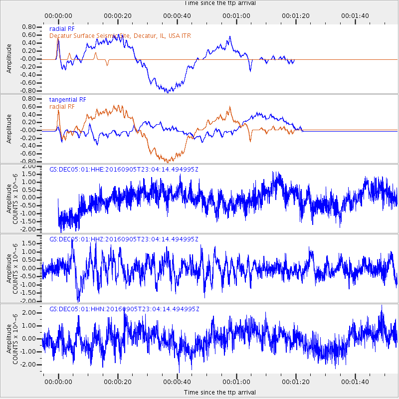
DEC05 Decatur Surface Seismic Site, Decatur, IL, USA - Earthquake Result Viewer
*The percent match for this event was below the threshold and hence no stack was calculated.
| Earthquake location: |
Komandorskiye Ostrova Region |
| Earthquake latitude/longitude: |
54.3/168.6 |
| Earthquake time(UTC): |
2016/09/05 (249) 22:54:04 GMT |
| Earthquake Depth: |
10 km |
| Earthquake Magnitude: |
5.7 MB |
| Earthquake Catalog/Contributor: |
NEIC PDE/NEIC COMCAT |
|
| Network: |
GS US Geological Survey Networks |
| Station: |
DEC05 Decatur Surface Seismic Site, Decatur, IL, USA |
| Lat/Lon: |
39.87 N/88.87 W |
| Elevation: |
216 m |
|
| Distance: |
65.2 deg |
| Az: |
55.866 deg |
| Baz: |
320.973 deg |
| Ray Param: |
$rayparam |
*The percent match for this event was below the threshold and hence was not used in the summary stack. |
|
| Radial Match: |
51.137325 % |
| Radial Bump: |
400 |
| Transverse Match: |
40.513203 % |
| Transverse Bump: |
400 |
| SOD ConfigId: |
1634031 |
| Insert Time: |
2016-09-19 22:55:48.657 +0000 |
| GWidth: |
2.5 |
| Max Bumps: |
400 |
| Tol: |
0.001 |
|
Signal To Noise
| Channel | StoN | STA | LTA |
| GS:DEC05:01:HHZ:20160905T23:04:14.494995Z | 1.8815401 | 5.4237313E-7 | 2.882602E-7 |
| GS:DEC05:01:HHN:20160905T23:04:14.494995Z | 1.4993005 | 8.2563525E-7 | 5.506803E-7 |
| GS:DEC05:01:HHE:20160905T23:04:14.494995Z | 1.4177208 | 9.659842E-7 | 6.8136427E-7 |
| Arrivals |
| Ps | |
| PpPs | |
| PsPs/PpSs | |


