You are here: Home > Network List > TA - USArray Transportable Network (new EarthScope stations) Stations List
> Station G24A Alzada, MT, USA > Earthquake Result Viewer
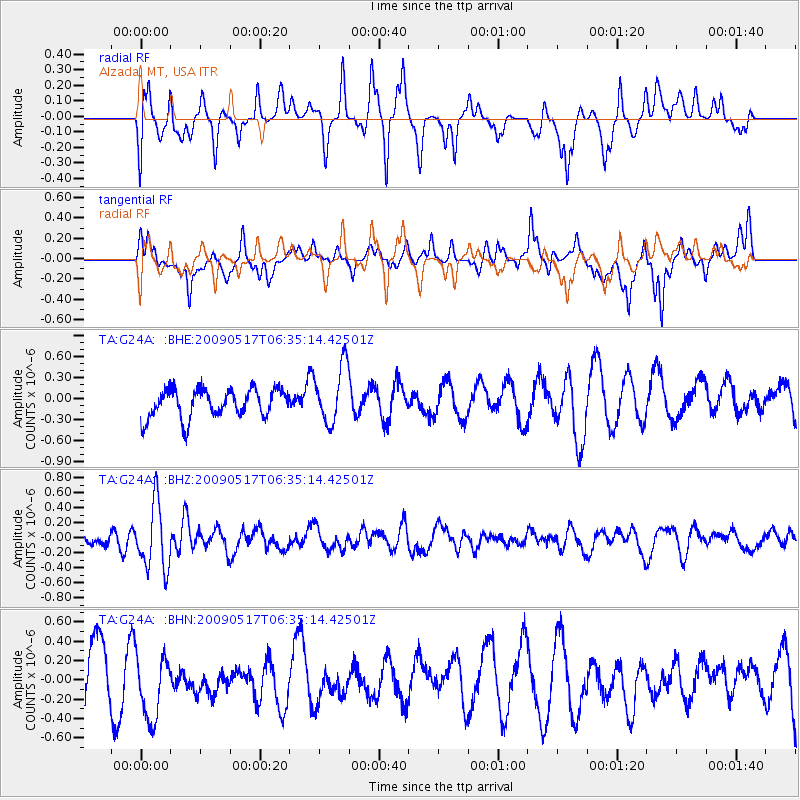
G24A Alzada, MT, USA - Earthquake Result Viewer
*The percent match for this event was below the threshold and hence no stack was calculated.
| Earthquake location: |
Tonga Islands |
| Earthquake latitude/longitude: |
-16.8/-173.5 |
| Earthquake time(UTC): |
2009/05/17 (137) 06:23:03 GMT |
| Earthquake Depth: |
67 km |
| Earthquake Magnitude: |
5.5 MB, 5.6 MW, 5.6 MW |
| Earthquake Catalog/Contributor: |
WHDF/NEIC |
|
| Network: |
TA USArray Transportable Network (new EarthScope stations) |
| Station: |
G24A Alzada, MT, USA |
| Lat/Lon: |
45.33 N/104.42 W |
| Elevation: |
1147 m |
|
| Distance: |
87.9 deg |
| Az: |
41.252 deg |
| Baz: |
243.533 deg |
| Ray Param: |
$rayparam |
*The percent match for this event was below the threshold and hence was not used in the summary stack. |
|
| Radial Match: |
51.241352 % |
| Radial Bump: |
326 |
| Transverse Match: |
60.693443 % |
| Transverse Bump: |
400 |
| SOD ConfigId: |
2760 |
| Insert Time: |
2010-03-06 19:12:23.930 +0000 |
| GWidth: |
2.5 |
| Max Bumps: |
400 |
| Tol: |
0.001 |
|
Signal To Noise
| Channel | StoN | STA | LTA |
| TA:G24A: :BHZ:20090517T06:35:14.42501Z | 3.3718672 | 4.343862E-7 | 1.288266E-7 |
| TA:G24A: :BHN:20090517T06:35:14.42501Z | 1.129031 | 3.6155078E-7 | 3.2023107E-7 |
| TA:G24A: :BHE:20090517T06:35:14.42501Z | 2.0382824 | 4.176842E-7 | 2.0491969E-7 |
| Arrivals |
| Ps | |
| PpPs | |
| PsPs/PpSs | |


