You are here: Home > Network List > TA - USArray Transportable Network (new EarthScope stations) Stations List
> Station G24A Alzada, MT, USA > Earthquake Result Viewer
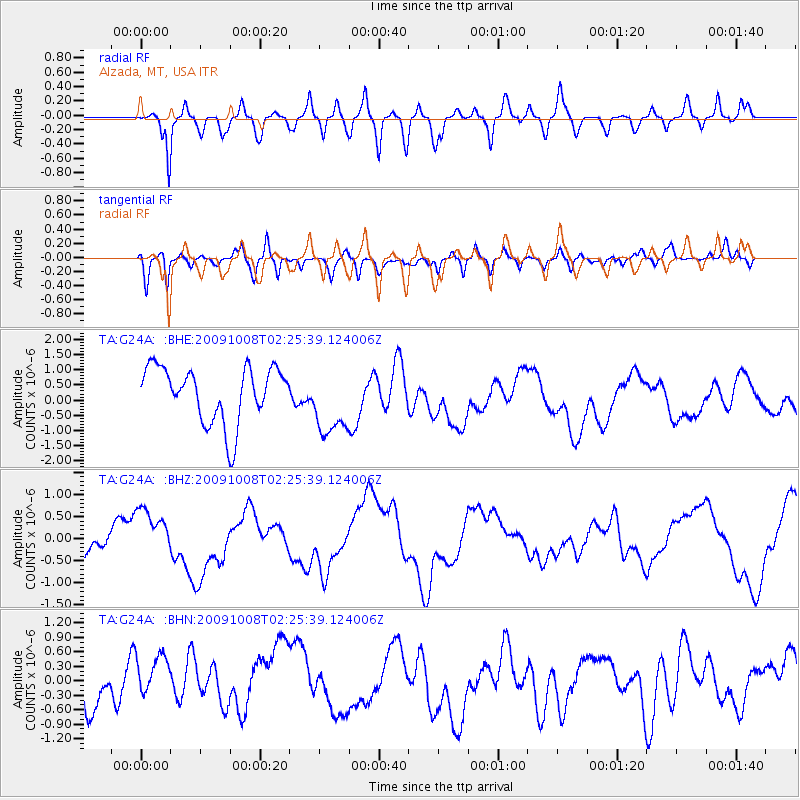
G24A Alzada, MT, USA - Earthquake Result Viewer
*The percent match for this event was below the threshold and hence no stack was calculated.
| Earthquake location: |
Santa Cruz Islands |
| Earthquake latitude/longitude: |
-11.7/166.2 |
| Earthquake time(UTC): |
2009/10/08 (281) 02:12:39 GMT |
| Earthquake Depth: |
35 km |
| Earthquake Magnitude: |
5.8 MB, 6.6 MW |
| Earthquake Catalog/Contributor: |
WHDF/NEIC |
|
| Network: |
TA USArray Transportable Network (new EarthScope stations) |
| Station: |
G24A Alzada, MT, USA |
| Lat/Lon: |
45.33 N/104.42 W |
| Elevation: |
1147 m |
|
| Distance: |
97.8 deg |
| Az: |
45.392 deg |
| Baz: |
261.36 deg |
| Ray Param: |
$rayparam |
*The percent match for this event was below the threshold and hence was not used in the summary stack. |
|
| Radial Match: |
62.233147 % |
| Radial Bump: |
400 |
| Transverse Match: |
44.448456 % |
| Transverse Bump: |
400 |
| SOD ConfigId: |
2622 |
| Insert Time: |
2010-03-06 19:12:48.122 +0000 |
| GWidth: |
2.5 |
| Max Bumps: |
400 |
| Tol: |
0.001 |
|
Signal To Noise
| Channel | StoN | STA | LTA |
| TA:G24A: :BHZ:20091008T02:25:39.124006Z | 1.7585698 | 5.3216473E-7 | 3.0261222E-7 |
| TA:G24A: :BHN:20091008T02:25:39.124006Z | 1.9215007 | 5.829941E-7 | 3.034056E-7 |
| TA:G24A: :BHE:20091008T02:25:39.124006Z | 1.243927 | 1.139741E-6 | 9.162443E-7 |
| Arrivals |
| Ps | |
| PpPs | |
| PsPs/PpSs | |


