You are here: Home > Network List > TA - USArray Transportable Network (new EarthScope stations) Stations List
> Station G24A Alzada, MT, USA > Earthquake Result Viewer
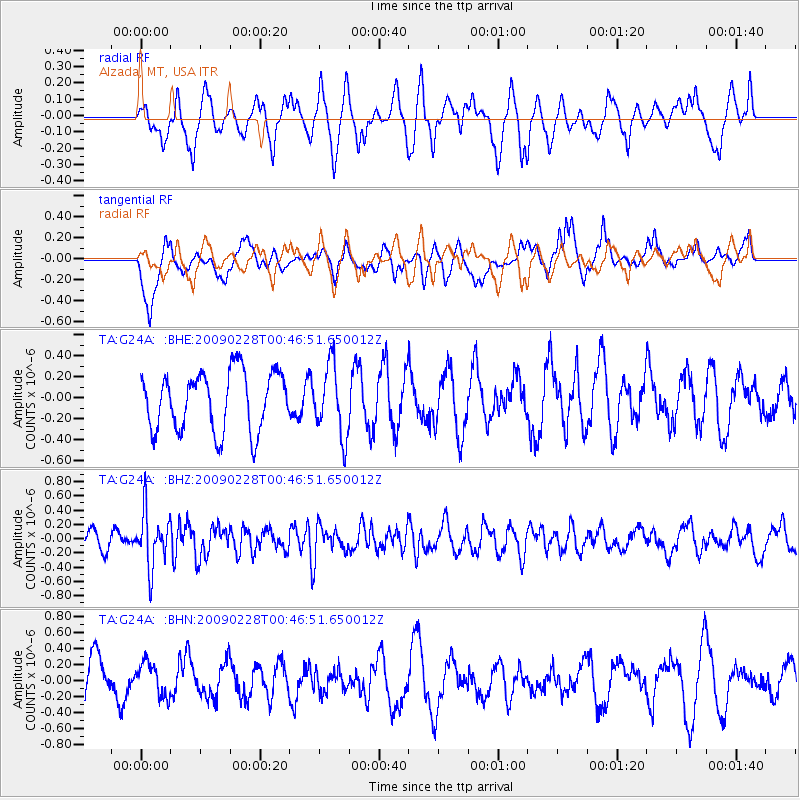
G24A Alzada, MT, USA - Earthquake Result Viewer
*The percent match for this event was below the threshold and hence no stack was calculated.
| Earthquake location: |
Hokkaido, Japan Region |
| Earthquake latitude/longitude: |
42.6/142.1 |
| Earthquake time(UTC): |
2009/02/28 (059) 00:35:56 GMT |
| Earthquake Depth: |
105 km |
| Earthquake Magnitude: |
5.5 MB, 5.5 MW, 5.5 MW |
| Earthquake Catalog/Contributor: |
WHDF/NEIC |
|
| Network: |
TA USArray Transportable Network (new EarthScope stations) |
| Station: |
G24A Alzada, MT, USA |
| Lat/Lon: |
45.33 N/104.42 W |
| Elevation: |
1147 m |
|
| Distance: |
74.3 deg |
| Az: |
42.229 deg |
| Baz: |
315.303 deg |
| Ray Param: |
$rayparam |
*The percent match for this event was below the threshold and hence was not used in the summary stack. |
|
| Radial Match: |
54.999508 % |
| Radial Bump: |
400 |
| Transverse Match: |
46.988323 % |
| Transverse Bump: |
400 |
| SOD ConfigId: |
2658 |
| Insert Time: |
2010-03-06 19:13:00.244 +0000 |
| GWidth: |
2.5 |
| Max Bumps: |
400 |
| Tol: |
0.001 |
|
Signal To Noise
| Channel | StoN | STA | LTA |
| TA:G24A: :BHZ:20090228T00:46:51.650012Z | 2.362083 | 3.816907E-7 | 1.6159073E-7 |
| TA:G24A: :BHN:20090228T00:46:51.650012Z | 0.7044278 | 2.0858695E-7 | 2.9610834E-7 |
| TA:G24A: :BHE:20090228T00:46:51.650012Z | 1.199686 | 3.3350307E-7 | 2.7799194E-7 |
| Arrivals |
| Ps | |
| PpPs | |
| PsPs/PpSs | |


