You are here: Home > Network List > TA - USArray Transportable Network (new EarthScope stations) Stations List
> Station G24A Alzada, MT, USA > Earthquake Result Viewer
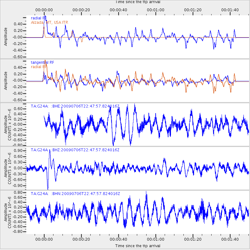
G24A Alzada, MT, USA - Earthquake Result Viewer
*The percent match for this event was below the threshold and hence no stack was calculated.
| Earthquake location: |
Southeast Of Ryukyu Islands |
| Earthquake latitude/longitude: |
24.9/128.0 |
| Earthquake time(UTC): |
2009/07/06 (187) 22:35:05 GMT |
| Earthquake Depth: |
10 km |
| Earthquake Magnitude: |
6.1 MB, 5.3 MS, 5.7 MW, 5.7 MW |
| Earthquake Catalog/Contributor: |
WHDF/NEIC |
|
| Network: |
TA USArray Transportable Network (new EarthScope stations) |
| Station: |
G24A Alzada, MT, USA |
| Lat/Lon: |
45.33 N/104.42 W |
| Elevation: |
1147 m |
|
| Distance: |
95.4 deg |
| Az: |
34.175 deg |
| Baz: |
313.675 deg |
| Ray Param: |
$rayparam |
*The percent match for this event was below the threshold and hence was not used in the summary stack. |
|
| Radial Match: |
54.73888 % |
| Radial Bump: |
345 |
| Transverse Match: |
58.34239 % |
| Transverse Bump: |
400 |
| SOD ConfigId: |
2648 |
| Insert Time: |
2010-03-06 19:13:18.988 +0000 |
| GWidth: |
2.5 |
| Max Bumps: |
400 |
| Tol: |
0.001 |
|
Signal To Noise
| Channel | StoN | STA | LTA |
| TA:G24A: :BHZ:20090706T22:47:57.824016Z | 5.6090484 | 4.5975182E-7 | 8.19661E-8 |
| TA:G24A: :BHN:20090706T22:47:57.824016Z | 0.83507854 | 1.7230498E-7 | 2.0633385E-7 |
| TA:G24A: :BHE:20090706T22:47:57.824016Z | 0.8181006 | 1.8508936E-7 | 2.262428E-7 |
| Arrivals |
| Ps | |
| PpPs | |
| PsPs/PpSs | |


