You are here: Home > Network List > TA - USArray Transportable Network (new EarthScope stations) Stations List
> Station G24A Alzada, MT, USA > Earthquake Result Viewer
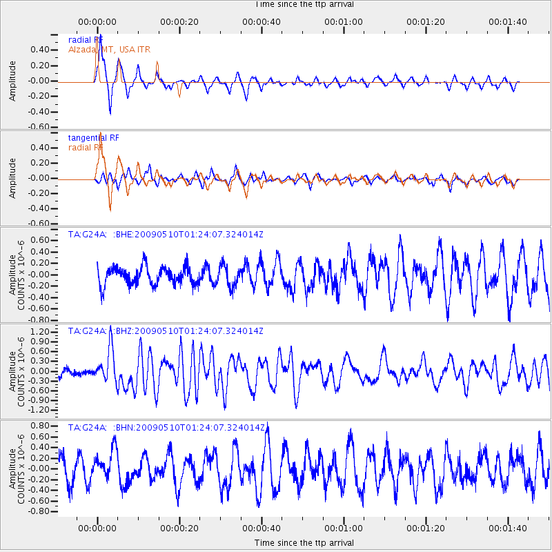
G24A Alzada, MT, USA - Earthquake Result Viewer
*The percent match for this event was below the threshold and hence no stack was calculated.
| Earthquake location: |
Off Coast Of Ecuador |
| Earthquake latitude/longitude: |
1.4/-85.2 |
| Earthquake time(UTC): |
2009/05/10 (130) 01:16:06 GMT |
| Earthquake Depth: |
6.0 km |
| Earthquake Magnitude: |
5.5 MB, 5.7 MS, 6.1 MW, 6.1 MW |
| Earthquake Catalog/Contributor: |
WHDF/NEIC |
|
| Network: |
TA USArray Transportable Network (new EarthScope stations) |
| Station: |
G24A Alzada, MT, USA |
| Lat/Lon: |
45.33 N/104.42 W |
| Elevation: |
1147 m |
|
| Distance: |
46.9 deg |
| Az: |
341.438 deg |
| Baz: |
153.183 deg |
| Ray Param: |
$rayparam |
*The percent match for this event was below the threshold and hence was not used in the summary stack. |
|
| Radial Match: |
76.9175 % |
| Radial Bump: |
329 |
| Transverse Match: |
58.848873 % |
| Transverse Bump: |
400 |
| SOD ConfigId: |
2760 |
| Insert Time: |
2010-03-06 19:13:34.982 +0000 |
| GWidth: |
2.5 |
| Max Bumps: |
400 |
| Tol: |
0.001 |
|
Signal To Noise
| Channel | StoN | STA | LTA |
| TA:G24A: :BHZ:20090510T01:24:07.324014Z | 5.337576 | 5.2748857E-7 | 9.882549E-8 |
| TA:G24A: :BHN:20090510T01:24:07.324014Z | 1.4372581 | 2.8954616E-7 | 2.0145733E-7 |
| TA:G24A: :BHE:20090510T01:24:07.324014Z | 1.1701671 | 1.8263549E-7 | 1.5607642E-7 |
| Arrivals |
| Ps | |
| PpPs | |
| PsPs/PpSs | |


