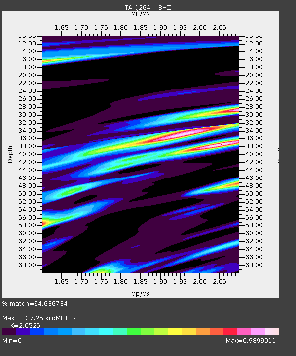
Q26A Hugo, CO, USA - Earthquake Result Viewer

Earthquake location: Rat Islands, Aleutian Islands
Earthquake latitude/longitude: 50.4/177.0
Earthquake time(UTC): 2009/07/06 (187) 14:53:12 GMT
Earthquake Depth: 22 km
Earthquake Magnitude: 6.0 MB, 5.8 MS, 6.1 MW, 6.0 MW
Earthquake Catalog/Contributor: WHDF/NEIC
Network: TA USArray Transportable Network (new EarthScope stations)
Station: Q26A Hugo, CO, USA
Lat/Lon: 38.92 N/103.52 W
Elevation: 1546 m
Distance: 55.1 deg
Az: 69.239 deg
Baz: 309.952 deg
Ray Param: 0.06498291
Estimated Moho Depth: 37.25 km
Estimated Crust Vp/Vs: 2.05
Assumed Crust Vp: 6.242 km/s
Estimated Crust Vs: 3.041 km/s
Estimated Crust Poisson's Ratio: 0.34
Radial Match: 94.636734 %
Radial Bump: 328
Transverse Match: 82.073524 %
Transverse Bump: 400
SOD ConfigId: 2648
Insert Time: 2010-03-06 19:14:08.078 +0000
GWidth: 2.5
Max Bumps: 400
Tol: 0.001

Signal To Noise

ChannelStoNSTALTA
TA:Q26A: :BHZ:20090706T15:02:11.648997Z18.973942.4654637E-61.2993947E-7
TA:Q26A: :BHN:20090706T15:02:11.648997Z5.5426611.0149788E-61.831212E-7
TA:Q26A: :BHE:20090706T15:02:11.648997Z7.72136161.3732074E-61.7784524E-7
Arrivals
Ps6.6 SECOND
PpPs17 SECOND
PsPs/PpSs24 SECOND