You are here: Home > Network List > TA - USArray Transportable Network (new EarthScope stations) Stations List
> Station Q26A Hugo, CO, USA > Earthquake Result Viewer
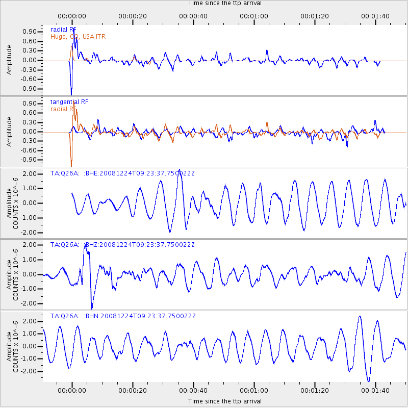
Q26A Hugo, CO, USA - Earthquake Result Viewer
*The percent match for this event was below the threshold and hence no stack was calculated.
| Earthquake location: |
Tonga Islands Region |
| Earthquake latitude/longitude: |
-17.3/-171.9 |
| Earthquake time(UTC): |
2008/12/24 (359) 09:11:34 GMT |
| Earthquake Depth: |
9.0 km |
| Earthquake Magnitude: |
5.9 MB, 5.6 MS, 6.0 MW, 6.0 MW |
| Earthquake Catalog/Contributor: |
WHDF/NEIC |
|
| Network: |
TA USArray Transportable Network (new EarthScope stations) |
| Station: |
Q26A Hugo, CO, USA |
| Lat/Lon: |
38.92 N/103.52 W |
| Elevation: |
1546 m |
|
| Distance: |
84.9 deg |
| Az: |
46.731 deg |
| Baz: |
243.102 deg |
| Ray Param: |
$rayparam |
*The percent match for this event was below the threshold and hence was not used in the summary stack. |
|
| Radial Match: |
73.382484 % |
| Radial Bump: |
400 |
| Transverse Match: |
54.718266 % |
| Transverse Bump: |
345 |
| SOD ConfigId: |
2658 |
| Insert Time: |
2010-03-06 19:14:59.886 +0000 |
| GWidth: |
2.5 |
| Max Bumps: |
400 |
| Tol: |
0.001 |
|
Signal To Noise
| Channel | StoN | STA | LTA |
| TA:Q26A: :BHZ:20081224T09:23:37.750022Z | 4.0487347 | 9.396111E-7 | 2.3207525E-7 |
| TA:Q26A: :BHN:20081224T09:23:37.750022Z | 1.068359 | 1.1466237E-6 | 1.073257E-6 |
| TA:Q26A: :BHE:20081224T09:23:37.750022Z | 2.5372148 | 1.1921894E-6 | 4.6988114E-7 |
| Arrivals |
| Ps | |
| PpPs | |
| PsPs/PpSs | |


