You are here: Home > Network List > TA - USArray Transportable Network (new EarthScope stations) Stations List
> Station B18K Kokolik River, AK, USA > Earthquake Result Viewer
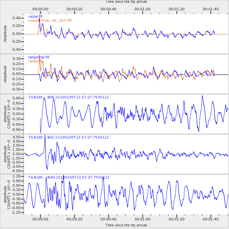
B18K Kokolik River, AK, USA - Earthquake Result Viewer
*The percent match for this event was below the threshold and hence no stack was calculated.
| Earthquake location: |
Iran-Iraq Border Region |
| Earthquake latitude/longitude: |
34.1/45.7 |
| Earthquake time(UTC): |
2019/01/06 (006) 13:42:01 GMT |
| Earthquake Depth: |
25 km |
| Earthquake Magnitude: |
5.8 mb |
| Earthquake Catalog/Contributor: |
NEIC PDE/us |
|
| Network: |
TA USArray Transportable Network (new EarthScope stations) |
| Station: |
B18K Kokolik River, AK, USA |
| Lat/Lon: |
69.36 N/161.80 W |
| Elevation: |
222 m |
|
| Distance: |
74.9 deg |
| Az: |
9.755 deg |
| Baz: |
336.643 deg |
| Ray Param: |
$rayparam |
*The percent match for this event was below the threshold and hence was not used in the summary stack. |
|
| Radial Match: |
63.237488 % |
| Radial Bump: |
400 |
| Transverse Match: |
52.077694 % |
| Transverse Bump: |
375 |
| SOD ConfigId: |
13570011 |
| Insert Time: |
2019-05-02 06:37:10.086 +0000 |
| GWidth: |
2.5 |
| Max Bumps: |
400 |
| Tol: |
0.001 |
|
Signal To Noise
| Channel | StoN | STA | LTA |
| TA:B18K: :BHZ:20190106T13:53:07.750012Z | 4.8746977 | 1.8474697E-6 | 3.7899164E-7 |
| TA:B18K: :BHN:20190106T13:53:07.750012Z | 1.7607899 | 5.272796E-7 | 2.994563E-7 |
| TA:B18K: :BHE:20190106T13:53:07.750012Z | 1.0747497 | 4.808499E-7 | 4.474064E-7 |
| Arrivals |
| Ps | |
| PpPs | |
| PsPs/PpSs | |


