You are here: Home > Network List > TA - USArray Transportable Network (new EarthScope stations) Stations List
> Station P17K Kvichak River, AK, USA > Earthquake Result Viewer
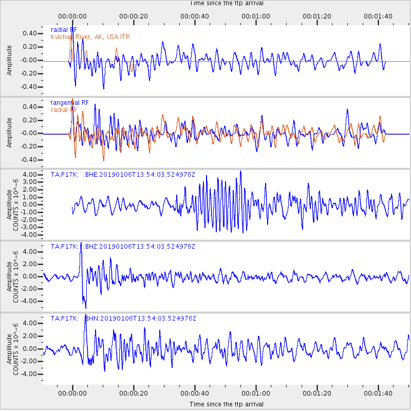
P17K Kvichak River, AK, USA - Earthquake Result Viewer
*The percent match for this event was below the threshold and hence no stack was calculated.
| Earthquake location: |
Iran-Iraq Border Region |
| Earthquake latitude/longitude: |
34.1/45.7 |
| Earthquake time(UTC): |
2019/01/06 (006) 13:42:01 GMT |
| Earthquake Depth: |
25 km |
| Earthquake Magnitude: |
5.8 mb |
| Earthquake Catalog/Contributor: |
NEIC PDE/us |
|
| Network: |
TA USArray Transportable Network (new EarthScope stations) |
| Station: |
P17K Kvichak River, AK, USA |
| Lat/Lon: |
59.20 N/156.44 W |
| Elevation: |
91 m |
|
| Distance: |
85.2 deg |
| Az: |
11.209 deg |
| Baz: |
341.741 deg |
| Ray Param: |
$rayparam |
*The percent match for this event was below the threshold and hence was not used in the summary stack. |
|
| Radial Match: |
52.18945 % |
| Radial Bump: |
400 |
| Transverse Match: |
67.19832 % |
| Transverse Bump: |
400 |
| SOD ConfigId: |
13570011 |
| Insert Time: |
2019-05-02 06:39:00.649 +0000 |
| GWidth: |
2.5 |
| Max Bumps: |
400 |
| Tol: |
0.001 |
|
Signal To Noise
| Channel | StoN | STA | LTA |
| TA:P17K: :BHZ:20190106T13:54:03.524976Z | 5.2270164 | 2.5338845E-6 | 4.8476693E-7 |
| TA:P17K: :BHN:20190106T13:54:03.524976Z | 2.3233802 | 1.8167715E-6 | 7.819519E-7 |
| TA:P17K: :BHE:20190106T13:54:03.524976Z | 1.0642635 | 6.202197E-7 | 5.8276896E-7 |
| Arrivals |
| Ps | |
| PpPs | |
| PsPs/PpSs | |


