
J19A Crowheart, WY, USA - Earthquake Result Viewer
| ||||||||||||||||||
| ||||||||||||||||||
| ||||||||||||||||||
|
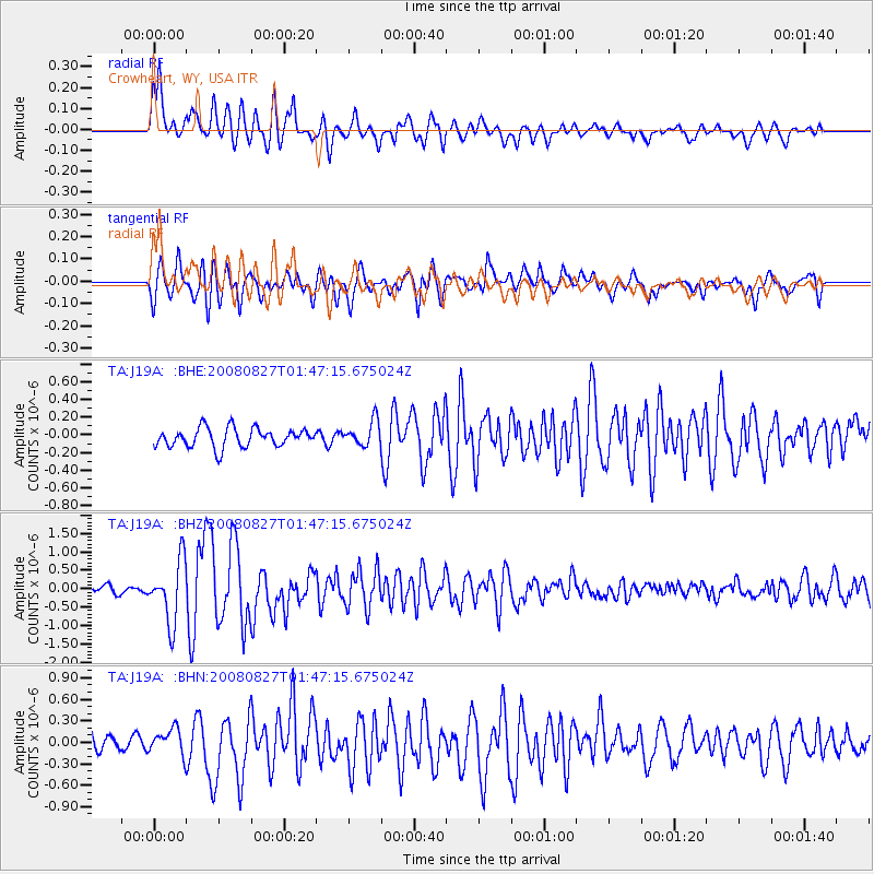
Signal To Noise
| Channel | StoN | STA | LTA |
| TA:J19A: :BHZ:20080827T01:47:15.675024Z | 9.149295 | 8.293616E-7 | 9.0647596E-8 |
| TA:J19A: :BHN:20080827T01:47:15.675024Z | 1.9103794 | 1.8136046E-7 | 9.493426E-8 |
| TA:J19A: :BHE:20080827T01:47:15.675024Z | 1.3576437 | 1.4298188E-7 | 1.05316204E-7 |
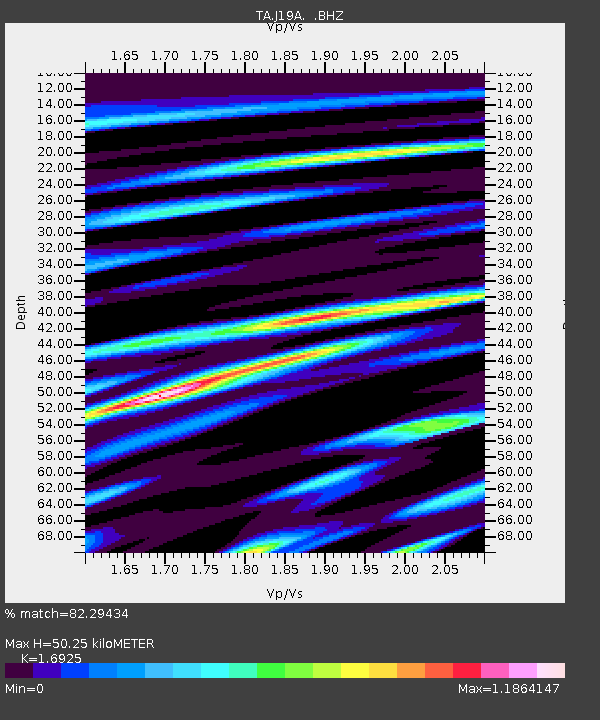
| Arrivals | |
| Ps | 5.8 SECOND |
| PpPs | 21 SECOND |
| PsPs/PpSs | 27 SECOND |

