J19A Crowheart, WY, USA - Earthquake Result Viewer
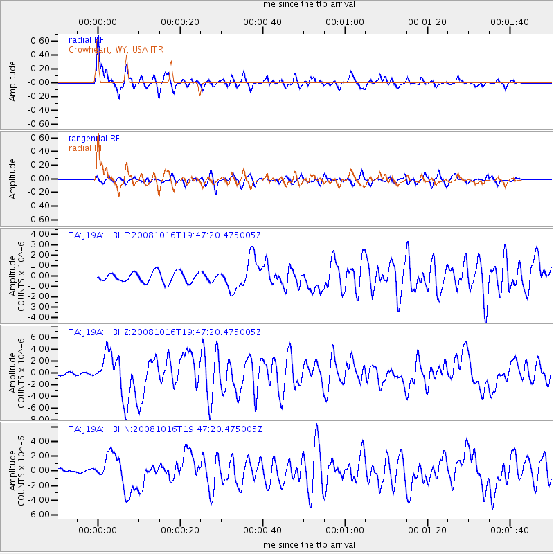
Earthquake location: Near Coast Of Chiapas, Mexico
Earthquake latitude/longitude: 14.4/-92.4
Earthquake time(UTC): 2008/10/16 (290) 19:41:25 GMT
Earthquake Depth: 24 km
Earthquake Magnitude: 6.1 MB, 6.6 MS, 6.7 MW, 6.6 MW
Earthquake Catalog/Contributor: WHDF/NEIC
Network: TA USArray Transportable Network (new EarthScope stations)
Station: J19A Crowheart, WY, USA
Lat/Lon: 43.26 N/109.05 W
Elevation: 1782 m
Distance: 32.1 deg
Az: 336.759 deg
Baz: 148.441 deg
Ray Param: 0.078759916
Estimated Moho Depth: 17.75 km
Estimated Crust Vp/Vs: 1.66
Assumed Crust Vp: 6.161 km/s
Estimated Crust Vs: 3.706 km/s
Estimated Crust Poisson's Ratio: 0.22
Radial Match: 90.6299 %
Radial Bump: 400
Transverse Match: 69.83421 %
Transverse Bump: 400
SOD ConfigId: 2556
Insert Time: 2010-03-06 19:18:15.798 +0000
GWidth: 2.5
Max Bumps: 400
Tol: 0.001

Signal To Noise

ChannelStoNSTALTA
TA:J19A: :BHZ:20081016T19:47:20.475005Z10.8391382.6789583E-62.4715604E-7
TA:J19A: :BHN:20081016T19:47:20.475005Z5.2343931.8528476E-63.5397562E-7
TA:J19A: :BHE:20081016T19:47:20.475005Z2.02924169.859835E-74.858877E-7
Arrivals
Ps2.1 SECOND
PpPs7.1 SECOND
PsPs/PpSs9.2 SECOND