You are here: Home > Network List > IU - Global Seismograph Network (GSN - IRIS/USGS) Stations List
> Station RSSD Black Hills, South Dakota, USA > Earthquake Result Viewer
RSSD Black Hills, South Dakota, USA - Earthquake Result Viewer
*The percent match for this event was below the threshold and hence no stack was calculated.
| Earthquake location: |
Komandorskiye Ostrova Region |
| Earthquake latitude/longitude: |
54.6/168.6 |
| Earthquake time(UTC): |
2016/09/07 (251) 20:07:36 GMT |
| Earthquake Depth: |
10 km |
| Earthquake Magnitude: |
5.5 MB |
| Earthquake Catalog/Contributor: |
NEIC PDE/NEIC COMCAT |
|
| Network: |
IU Global Seismograph Network (GSN - IRIS/USGS) |
| Station: |
RSSD Black Hills, South Dakota, USA |
| Lat/Lon: |
44.12 N/104.04 W |
| Elevation: |
2090 m |
|
| Distance: |
54.3 deg |
| Az: |
62.368 deg |
| Baz: |
314.26 deg |
| Ray Param: |
$rayparam |
*The percent match for this event was below the threshold and hence was not used in the summary stack. |
|
| Radial Match: |
66.87678 % |
| Radial Bump: |
400 |
| Transverse Match: |
52.819515 % |
| Transverse Bump: |
400 |
| SOD ConfigId: |
1634031 |
| Insert Time: |
2016-09-21 20:15:17.948 +0000 |
| GWidth: |
2.5 |
| Max Bumps: |
400 |
| Tol: |
0.001 |
|
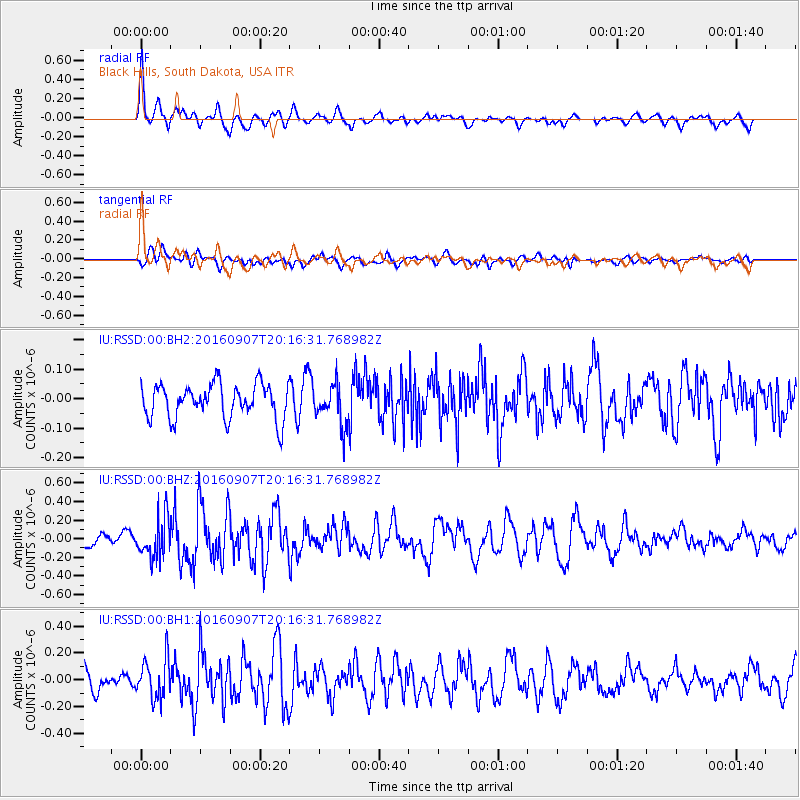
Signal To Noise
| Channel | StoN | STA | LTA |
| IU:RSSD:00:BHZ:20160907T20:16:31.768982Z | 3.2162185 | 2.1185667E-7 | 6.5871355E-8 |
| IU:RSSD:00:BH1:20160907T20:16:31.768982Z | 1.5429742 | 1.5011196E-7 | 9.728741E-8 |
| IU:RSSD:00:BH2:20160907T20:16:31.768982Z | 1.168367 | 6.833609E-8 | 5.8488546E-8 |
| Arrivals |
| Ps | |
| PpPs | |
| PsPs/PpSs | |


