You are here: Home > Network List > TS - TERRAscope (Southern California Seismic Network) Stations List
> Station CALB Calabasas, California, USA > Earthquake Result Viewer
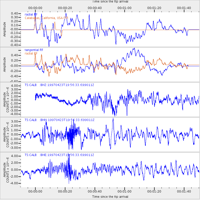
CALB Calabasas, California, USA - Earthquake Result Viewer
*The percent match for this event was below the threshold and hence no stack was calculated.
| Earthquake location: |
Mariana Islands |
| Earthquake latitude/longitude: |
14.0/144.9 |
| Earthquake time(UTC): |
1997/04/23 (113) 19:44:28 GMT |
| Earthquake Depth: |
101 km |
| Earthquake Magnitude: |
6.2 MB, 6.5 UNKNOWN, 6.5 MW |
| Earthquake Catalog/Contributor: |
WHDF/NEIC |
|
| Network: |
TS TERRAscope (Southern California Seismic Network) |
| Station: |
CALB Calabasas, California, USA |
| Lat/Lon: |
34.14 N/118.63 W |
| Elevation: |
0.0 m |
|
| Distance: |
87.5 deg |
| Az: |
55.576 deg |
| Baz: |
285.103 deg |
| Ray Param: |
$rayparam |
*The percent match for this event was below the threshold and hence was not used in the summary stack. |
|
| Radial Match: |
55.28565 % |
| Radial Bump: |
400 |
| Transverse Match: |
45.295837 % |
| Transverse Bump: |
400 |
| SOD ConfigId: |
4480 |
| Insert Time: |
2010-02-26 14:03:36.415 +0000 |
| GWidth: |
2.5 |
| Max Bumps: |
400 |
| Tol: |
0.001 |
|
Signal To Noise
| Channel | StoN | STA | LTA |
| TS:CALB: :BHN:19970423T19:56:33.699011Z | 2.3863735 | 8.012995E-7 | 3.3578127E-7 |
| TS:CALB: :BHE:19970423T19:56:33.699011Z | 0.83089614 | 9.83703E-7 | 1.1839061E-6 |
| TS:CALB: :BHZ:19970423T19:56:33.699011Z | 0.92332584 | 8.7578536E-7 | 9.4851174E-7 |
| Arrivals |
| Ps | |
| PpPs | |
| PsPs/PpSs | |


