
J19A Crowheart, WY, USA - Earthquake Result Viewer
| ||||||||||||||||||
| ||||||||||||||||||
| ||||||||||||||||||
|
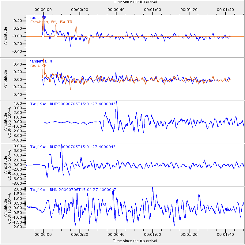
Signal To Noise
| Channel | StoN | STA | LTA |
| TA:J19A: :BHZ:20090706T15:01:27.400004Z | 14.903387 | 2.7763604E-6 | 1.8629058E-7 |
| TA:J19A: :BHN:20090706T15:01:27.400004Z | 3.7837906 | 5.417162E-7 | 1.431676E-7 |
| TA:J19A: :BHE:20090706T15:01:27.400004Z | 6.8902884 | 1.0737315E-6 | 1.558326E-7 |
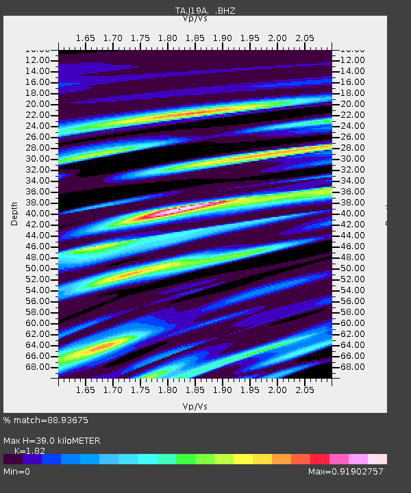
| Arrivals | |
| Ps | 5.5 SECOND |
| PpPs | 17 SECOND |
| PsPs/PpSs | 22 SECOND |

