You are here: Home > Network List > CN - Canadian National Seismograph Network Stations List
> Station INK INUVIK, NT > Earthquake Result Viewer
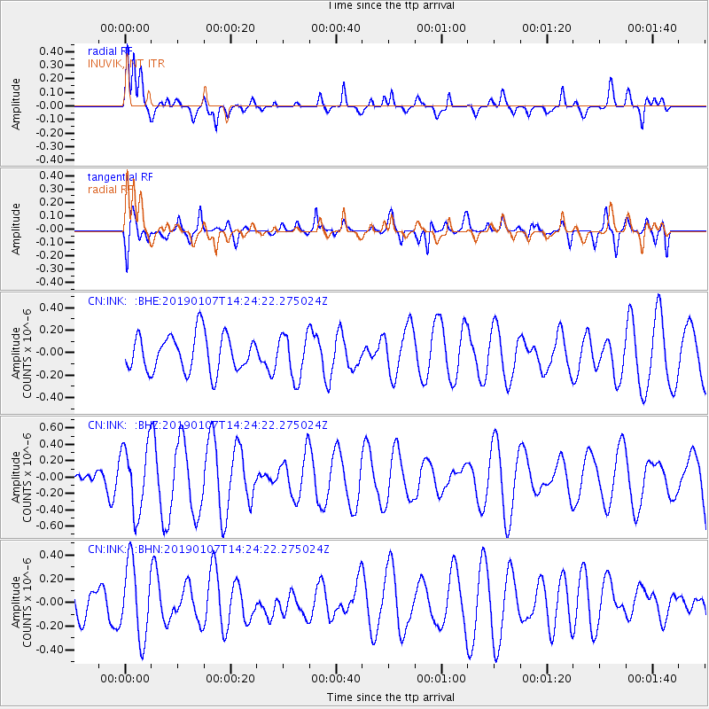
INK INUVIK, NT - Earthquake Result Viewer
*The percent match for this event was below the threshold and hence no stack was calculated.
| Earthquake location: |
Northern Molucca Sea |
| Earthquake latitude/longitude: |
2.4/126.8 |
| Earthquake time(UTC): |
2019/01/07 (007) 14:11:52 GMT |
| Earthquake Depth: |
46 km |
| Earthquake Magnitude: |
5.5 mb |
| Earthquake Catalog/Contributor: |
NEIC PDE/us |
|
| Network: |
CN Canadian National Seismograph Network |
| Station: |
INK INUVIK, NT |
| Lat/Lon: |
68.31 N/133.53 W |
| Elevation: |
44 m |
|
| Distance: |
91.3 deg |
| Az: |
21.506 deg |
| Baz: |
279.886 deg |
| Ray Param: |
$rayparam |
*The percent match for this event was below the threshold and hence was not used in the summary stack. |
|
| Radial Match: |
66.38636 % |
| Radial Bump: |
400 |
| Transverse Match: |
42.892155 % |
| Transverse Bump: |
400 |
| SOD ConfigId: |
13570011 |
| Insert Time: |
2019-05-02 06:52:29.786 +0000 |
| GWidth: |
2.5 |
| Max Bumps: |
400 |
| Tol: |
0.001 |
|
Signal To Noise
| Channel | StoN | STA | LTA |
| CN:INK: :BHZ:20190107T14:24:22.275024Z | 1.5607932 | 4.132851E-7 | 2.647917E-7 |
| CN:INK: :BHN:20190107T14:24:22.275024Z | 1.319423 | 3.157039E-7 | 2.3927421E-7 |
| CN:INK: :BHE:20190107T14:24:22.275024Z | 1.1536139 | 1.8862613E-7 | 1.6350889E-7 |
| Arrivals |
| Ps | |
| PpPs | |
| PsPs/PpSs | |


