You are here: Home > Network List > TA - USArray Transportable Network (new EarthScope stations) Stations List
> Station J19A Crowheart, WY, USA > Earthquake Result Viewer
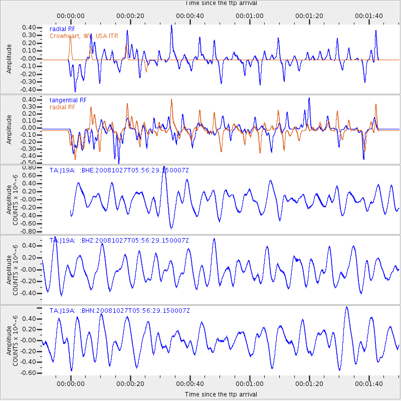
J19A Crowheart, WY, USA - Earthquake Result Viewer
*The percent match for this event was below the threshold and hence no stack was calculated.
| Earthquake location: |
Vanuatu Islands |
| Earthquake latitude/longitude: |
-14.6/167.2 |
| Earthquake time(UTC): |
2008/10/27 (301) 05:43:50 GMT |
| Earthquake Depth: |
129 km |
| Earthquake Magnitude: |
5.6 MW, 5.2 MB, 5.6 MW |
| Earthquake Catalog/Contributor: |
WHDF/NEIC |
|
| Network: |
TA USArray Transportable Network (new EarthScope stations) |
| Station: |
J19A Crowheart, WY, USA |
| Lat/Lon: |
43.26 N/109.05 W |
| Elevation: |
1782 m |
|
| Distance: |
95.4 deg |
| Az: |
46.839 deg |
| Baz: |
255.145 deg |
| Ray Param: |
$rayparam |
*The percent match for this event was below the threshold and hence was not used in the summary stack. |
|
| Radial Match: |
64.64359 % |
| Radial Bump: |
400 |
| Transverse Match: |
66.49302 % |
| Transverse Bump: |
400 |
| SOD ConfigId: |
2560 |
| Insert Time: |
2010-03-06 19:20:58.266 +0000 |
| GWidth: |
2.5 |
| Max Bumps: |
400 |
| Tol: |
0.001 |
|
Signal To Noise
| Channel | StoN | STA | LTA |
| TA:J19A: :BHZ:20081027T05:56:29.150007Z | 0.74072343 | 1.3608998E-7 | 1.8372576E-7 |
| TA:J19A: :BHN:20081027T05:56:29.150007Z | 1.7526355 | 3.0847E-7 | 1.7600351E-7 |
| TA:J19A: :BHE:20081027T05:56:29.150007Z | 2.5528774 | 5.116616E-7 | 2.0042543E-7 |
| Arrivals |
| Ps | |
| PpPs | |
| PsPs/PpSs | |


