You are here: Home > Network List > TA - USArray Transportable Network (new EarthScope stations) Stations List
> Station G21K Allakaket, AK, USA > Earthquake Result Viewer
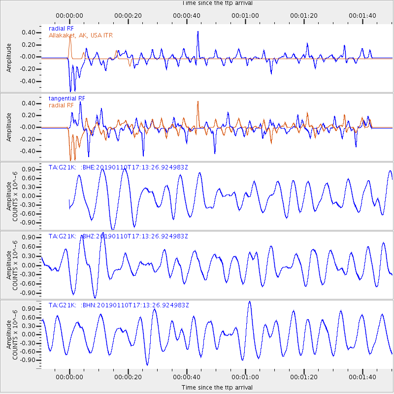
G21K Allakaket, AK, USA - Earthquake Result Viewer
*The percent match for this event was below the threshold and hence no stack was calculated.
| Earthquake location: |
South Of Tonga Islands |
| Earthquake latitude/longitude: |
-26.9/-175.5 |
| Earthquake time(UTC): |
2019/01/10 (010) 17:00:37 GMT |
| Earthquake Depth: |
10 km |
| Earthquake Magnitude: |
5.8 Mww |
| Earthquake Catalog/Contributor: |
NEIC PDE/us |
|
| Network: |
TA USArray Transportable Network (new EarthScope stations) |
| Station: |
G21K Allakaket, AK, USA |
| Lat/Lon: |
66.52 N/153.51 W |
| Elevation: |
446 m |
|
| Distance: |
94.6 deg |
| Az: |
8.658 deg |
| Baz: |
199.598 deg |
| Ray Param: |
$rayparam |
*The percent match for this event was below the threshold and hence was not used in the summary stack. |
|
| Radial Match: |
59.19992 % |
| Radial Bump: |
400 |
| Transverse Match: |
66.438446 % |
| Transverse Bump: |
385 |
| SOD ConfigId: |
13570011 |
| Insert Time: |
2019-05-02 07:16:10.595 +0000 |
| GWidth: |
2.5 |
| Max Bumps: |
400 |
| Tol: |
0.001 |
|
Signal To Noise
| Channel | StoN | STA | LTA |
| TA:G21K: :BHZ:20190110T17:13:26.924983Z | 2.0457904 | 6.6781735E-7 | 3.2643487E-7 |
| TA:G21K: :BHN:20190110T17:13:26.924983Z | 0.70857906 | 3.6260295E-7 | 5.117325E-7 |
| TA:G21K: :BHE:20190110T17:13:26.924983Z | 0.4173333 | 2.5331587E-7 | 6.06987E-7 |
| Arrivals |
| Ps | |
| PpPs | |
| PsPs/PpSs | |


