You are here: Home > Network List > TA - USArray Transportable Network (new EarthScope stations) Stations List
> Station D25K Kavik River, AK, USA > Earthquake Result Viewer
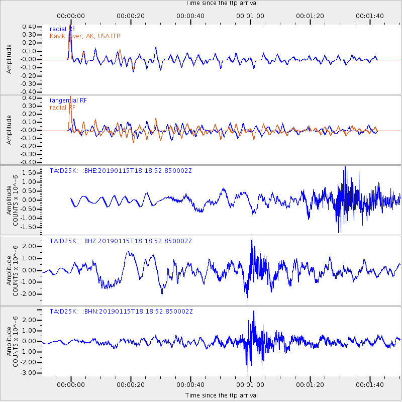
D25K Kavik River, AK, USA - Earthquake Result Viewer
*The percent match for this event was below the threshold and hence no stack was calculated.
| Earthquake location: |
Vanuatu Islands |
| Earthquake latitude/longitude: |
-13.4/166.8 |
| Earthquake time(UTC): |
2019/01/15 (015) 18:06:34 GMT |
| Earthquake Depth: |
35 km |
| Earthquake Magnitude: |
6.6 mww |
| Earthquake Catalog/Contributor: |
NEIC PDE/us |
|
| Network: |
TA USArray Transportable Network (new EarthScope stations) |
| Station: |
D25K Kavik River, AK, USA |
| Lat/Lon: |
69.32 N/146.38 W |
| Elevation: |
770 m |
|
| Distance: |
88.7 deg |
| Az: |
15.006 deg |
| Baz: |
225.193 deg |
| Ray Param: |
$rayparam |
*The percent match for this event was below the threshold and hence was not used in the summary stack. |
|
| Radial Match: |
76.811005 % |
| Radial Bump: |
400 |
| Transverse Match: |
66.80627 % |
| Transverse Bump: |
400 |
| SOD ConfigId: |
13570011 |
| Insert Time: |
2019-05-02 07:33:33.768 +0000 |
| GWidth: |
2.5 |
| Max Bumps: |
400 |
| Tol: |
0.001 |
|
Signal To Noise
| Channel | StoN | STA | LTA |
| TA:D25K: :BHZ:20190115T18:18:52.850002Z | 3.000795 | 3.979694E-7 | 1.3262132E-7 |
| TA:D25K: :BHN:20190115T18:18:52.850002Z | 1.0799211 | 1.4367649E-7 | 1.330435E-7 |
| TA:D25K: :BHE:20190115T18:18:52.850002Z | 0.8230267 | 1.4462351E-7 | 1.7572154E-7 |
| Arrivals |
| Ps | |
| PpPs | |
| PsPs/PpSs | |


