You are here: Home > Network List > TA - USArray Transportable Network (new EarthScope stations) Stations List
> Station G16K Koyuk River, AK, USA > Earthquake Result Viewer
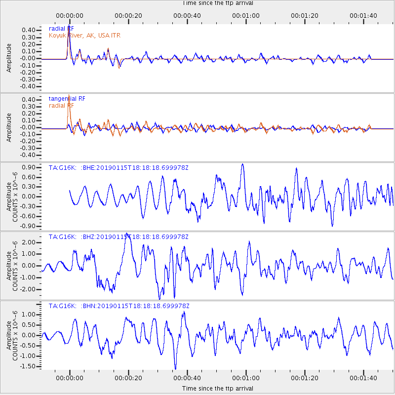
G16K Koyuk River, AK, USA - Earthquake Result Viewer
*The percent match for this event was below the threshold and hence no stack was calculated.
| Earthquake location: |
Vanuatu Islands |
| Earthquake latitude/longitude: |
-13.4/166.8 |
| Earthquake time(UTC): |
2019/01/15 (015) 18:06:34 GMT |
| Earthquake Depth: |
35 km |
| Earthquake Magnitude: |
6.6 mww |
| Earthquake Catalog/Contributor: |
NEIC PDE/us |
|
| Network: |
TA USArray Transportable Network (new EarthScope stations) |
| Station: |
G16K Koyuk River, AK, USA |
| Lat/Lon: |
65.39 N/162.35 W |
| Elevation: |
169 m |
|
| Distance: |
81.9 deg |
| Az: |
12.509 deg |
| Baz: |
210.231 deg |
| Ray Param: |
$rayparam |
*The percent match for this event was below the threshold and hence was not used in the summary stack. |
|
| Radial Match: |
79.24048 % |
| Radial Bump: |
328 |
| Transverse Match: |
60.57949 % |
| Transverse Bump: |
400 |
| SOD ConfigId: |
13570011 |
| Insert Time: |
2019-05-02 07:33:50.495 +0000 |
| GWidth: |
2.5 |
| Max Bumps: |
400 |
| Tol: |
0.001 |
|
Signal To Noise
| Channel | StoN | STA | LTA |
| TA:G16K: :BHZ:20190115T18:18:18.699978Z | 2.45753 | 6.521096E-7 | 2.6535164E-7 |
| TA:G16K: :BHN:20190115T18:18:18.699978Z | 1.4948556 | 4.3203073E-7 | 2.8901167E-7 |
| TA:G16K: :BHE:20190115T18:18:18.699978Z | 1.692836 | 3.5072287E-7 | 2.0718066E-7 |
| Arrivals |
| Ps | |
| PpPs | |
| PsPs/PpSs | |


