You are here: Home > Network List > TA - USArray Transportable Network (new EarthScope stations) Stations List
> Station B18K Kokolik River, AK, USA > Earthquake Result Viewer
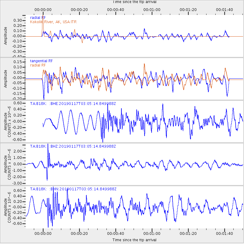
B18K Kokolik River, AK, USA - Earthquake Result Viewer
*The percent match for this event was below the threshold and hence no stack was calculated.
| Earthquake location: |
Nicobar Islands, India Region |
| Earthquake latitude/longitude: |
7.4/94.4 |
| Earthquake time(UTC): |
2019/01/17 (017) 02:53:07 GMT |
| Earthquake Depth: |
99 km |
| Earthquake Magnitude: |
5.4 Mww |
| Earthquake Catalog/Contributor: |
NEIC PDE/us |
|
| Network: |
TA USArray Transportable Network (new EarthScope stations) |
| Station: |
B18K Kokolik River, AK, USA |
| Lat/Lon: |
69.36 N/161.80 W |
| Elevation: |
222 m |
|
| Distance: |
87.9 deg |
| Az: |
20.15 deg |
| Baz: |
285.482 deg |
| Ray Param: |
$rayparam |
*The percent match for this event was below the threshold and hence was not used in the summary stack. |
|
| Radial Match: |
41.60063 % |
| Radial Bump: |
400 |
| Transverse Match: |
53.291702 % |
| Transverse Bump: |
400 |
| SOD ConfigId: |
13570011 |
| Insert Time: |
2019-05-02 07:43:34.171 +0000 |
| GWidth: |
2.5 |
| Max Bumps: |
400 |
| Tol: |
0.001 |
|
Signal To Noise
| Channel | StoN | STA | LTA |
| TA:B18K: :BHZ:20190117T03:05:14.849988Z | 3.796466 | 9.879274E-7 | 2.602229E-7 |
| TA:B18K: :BHN:20190117T03:05:14.849988Z | 1.0203651 | 2.4992474E-7 | 2.4493656E-7 |
| TA:B18K: :BHE:20190117T03:05:14.849988Z | 1.2856137 | 2.7502833E-7 | 2.1392766E-7 |
| Arrivals |
| Ps | |
| PpPs | |
| PsPs/PpSs | |


