You are here: Home > Network List > TA - USArray Transportable Network (new EarthScope stations) Stations List
> Station A23A Redstone, MT, USA > Earthquake Result Viewer
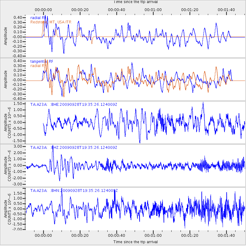
A23A Redstone, MT, USA - Earthquake Result Viewer
*The percent match for this event was below the threshold and hence no stack was calculated.
| Earthquake location: |
Ryukyu Islands, Japan |
| Earthquake latitude/longitude: |
27.9/127.8 |
| Earthquake time(UTC): |
2009/09/28 (271) 19:22:57 GMT |
| Earthquake Depth: |
9.0 km |
| Earthquake Magnitude: |
5.7 MB, 5.6 MS, 5.8 MW, 5.8 MW |
| Earthquake Catalog/Contributor: |
WHDF/NEIC |
|
| Network: |
TA USArray Transportable Network (new EarthScope stations) |
| Station: |
A23A Redstone, MT, USA |
| Lat/Lon: |
48.96 N/104.88 W |
| Elevation: |
665 m |
|
| Distance: |
90.2 deg |
| Az: |
31.621 deg |
| Baz: |
315.262 deg |
| Ray Param: |
$rayparam |
*The percent match for this event was below the threshold and hence was not used in the summary stack. |
|
| Radial Match: |
66.42321 % |
| Radial Bump: |
400 |
| Transverse Match: |
59.48114 % |
| Transverse Bump: |
400 |
| SOD ConfigId: |
2622 |
| Insert Time: |
2010-03-06 19:24:32.246 +0000 |
| GWidth: |
2.5 |
| Max Bumps: |
400 |
| Tol: |
0.001 |
|
Signal To Noise
| Channel | StoN | STA | LTA |
| TA:A23A: :BHZ:20090928T19:35:26.124009Z | 3.3610103 | 6.367451E-7 | 1.894505E-7 |
| TA:A23A: :BHN:20090928T19:35:26.124009Z | 1.0162754 | 3.5248348E-7 | 3.4683853E-7 |
| TA:A23A: :BHE:20090928T19:35:26.124009Z | 1.9033452 | 6.7172385E-7 | 3.5291748E-7 |
| Arrivals |
| Ps | |
| PpPs | |
| PsPs/PpSs | |


