You are here: Home > Network List > TA - USArray Transportable Network (new EarthScope stations) Stations List
> Station G31M Satah River, YT, CAN > Earthquake Result Viewer
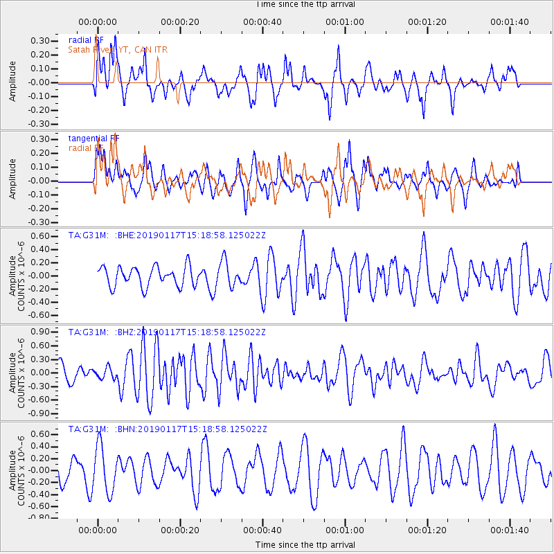
G31M Satah River, YT, CAN - Earthquake Result Viewer
*The percent match for this event was below the threshold and hence no stack was calculated.
| Earthquake location: |
Bismarck Sea |
| Earthquake latitude/longitude: |
-3.3/146.3 |
| Earthquake time(UTC): |
2019/01/17 (017) 15:06:35 GMT |
| Earthquake Depth: |
10 km |
| Earthquake Magnitude: |
6.2 Mww |
| Earthquake Catalog/Contributor: |
NEIC PDE/us |
|
| Network: |
TA USArray Transportable Network (new EarthScope stations) |
| Station: |
G31M Satah River, YT, CAN |
| Lat/Lon: |
66.92 N/134.27 W |
| Elevation: |
61 m |
|
| Distance: |
88.8 deg |
| Az: |
22.803 deg |
| Baz: |
258.986 deg |
| Ray Param: |
$rayparam |
*The percent match for this event was below the threshold and hence was not used in the summary stack. |
|
| Radial Match: |
66.45688 % |
| Radial Bump: |
400 |
| Transverse Match: |
43.24983 % |
| Transverse Bump: |
400 |
| SOD ConfigId: |
13570011 |
| Insert Time: |
2019-05-02 07:48:31.265 +0000 |
| GWidth: |
2.5 |
| Max Bumps: |
400 |
| Tol: |
0.001 |
|
Signal To Noise
| Channel | StoN | STA | LTA |
| TA:G31M: :BHZ:20190117T15:18:58.125022Z | 0.55510175 | 1.1805702E-7 | 2.1267635E-7 |
| TA:G31M: :BHN:20190117T15:18:58.125022Z | 2.1532087 | 3.8974432E-7 | 1.8100629E-7 |
| TA:G31M: :BHE:20190117T15:18:58.125022Z | 1.3220564 | 1.9618568E-7 | 1.4839432E-7 |
| Arrivals |
| Ps | |
| PpPs | |
| PsPs/PpSs | |


