You are here: Home > Network List > UW - Pacific Northwest Regional Seismic Network Stations List
> Station UMAT Pilot Rock, OR, USA > Earthquake Result Viewer
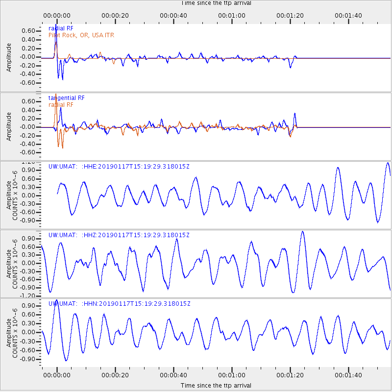
UMAT Pilot Rock, OR, USA - Earthquake Result Viewer
*The percent match for this event was below the threshold and hence no stack was calculated.
| Earthquake location: |
Bismarck Sea |
| Earthquake latitude/longitude: |
-3.3/146.3 |
| Earthquake time(UTC): |
2019/01/17 (017) 15:06:35 GMT |
| Earthquake Depth: |
10 km |
| Earthquake Magnitude: |
6.2 Mww |
| Earthquake Catalog/Contributor: |
NEIC PDE/us |
|
| Network: |
UW Pacific Northwest Regional Seismic Network |
| Station: |
UMAT Pilot Rock, OR, USA |
| Lat/Lon: |
45.29 N/118.96 W |
| Elevation: |
1318 m |
|
| Distance: |
95.6 deg |
| Az: |
44.984 deg |
| Baz: |
271.047 deg |
| Ray Param: |
$rayparam |
*The percent match for this event was below the threshold and hence was not used in the summary stack. |
|
| Radial Match: |
66.568825 % |
| Radial Bump: |
385 |
| Transverse Match: |
46.964695 % |
| Transverse Bump: |
400 |
| SOD ConfigId: |
13570011 |
| Insert Time: |
2019-05-02 07:49:15.361 +0000 |
| GWidth: |
2.5 |
| Max Bumps: |
400 |
| Tol: |
0.001 |
|
Signal To Noise
| Channel | StoN | STA | LTA |
| UW:UMAT: :HHZ:20190117T15:19:29.318015Z | 0.9650464 | 4.8562447E-7 | 5.032136E-7 |
| UW:UMAT: :HHN:20190117T15:19:29.318015Z | 1.6822168 | 7.393446E-7 | 4.3950615E-7 |
| UW:UMAT: :HHE:20190117T15:19:29.318015Z | 0.6762695 | 2.205933E-7 | 3.261914E-7 |
| Arrivals |
| Ps | |
| PpPs | |
| PsPs/PpSs | |


