You are here: Home > Network List > TA - USArray Transportable Network (new EarthScope stations) Stations List
> Station A23A Redstone, MT, USA > Earthquake Result Viewer
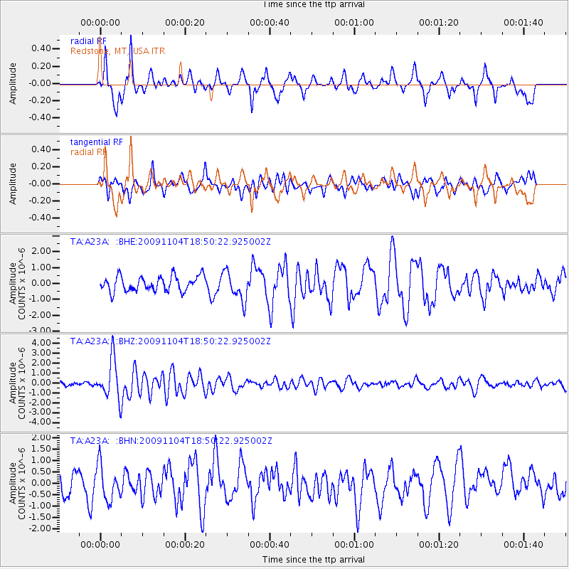
A23A Redstone, MT, USA - Earthquake Result Viewer
*The percent match for this event was below the threshold and hence no stack was calculated.
| Earthquake location: |
Azores Islands Region |
| Earthquake latitude/longitude: |
36.2/-33.9 |
| Earthquake time(UTC): |
2009/11/04 (308) 18:41:44 GMT |
| Earthquake Depth: |
10 km |
| Earthquake Magnitude: |
5.7 MB, 5.6 MS, 5.9 MW, 5.8 MW |
| Earthquake Catalog/Contributor: |
WHDF/NEIC |
|
| Network: |
TA USArray Transportable Network (new EarthScope stations) |
| Station: |
A23A Redstone, MT, USA |
| Lat/Lon: |
48.96 N/104.88 W |
| Elevation: |
665 m |
|
| Distance: |
52.0 deg |
| Az: |
307.756 deg |
| Baz: |
76.125 deg |
| Ray Param: |
$rayparam |
*The percent match for this event was below the threshold and hence was not used in the summary stack. |
|
| Radial Match: |
77.36281 % |
| Radial Bump: |
392 |
| Transverse Match: |
43.589363 % |
| Transverse Bump: |
400 |
| SOD ConfigId: |
2622 |
| Insert Time: |
2010-03-06 19:24:42.455 +0000 |
| GWidth: |
2.5 |
| Max Bumps: |
400 |
| Tol: |
0.001 |
|
Signal To Noise
| Channel | StoN | STA | LTA |
| TA:A23A: :BHZ:20091104T18:50:22.925002Z | 9.2997265 | 2.0139923E-6 | 2.165647E-7 |
| TA:A23A: :BHN:20091104T18:50:22.925002Z | 1.3404 | 7.8251514E-7 | 5.837923E-7 |
| TA:A23A: :BHE:20091104T18:50:22.925002Z | 1.9620852 | 9.160046E-7 | 4.6685258E-7 |
| Arrivals |
| Ps | |
| PpPs | |
| PsPs/PpSs | |


