You are here: Home > Network List > CI - Caltech Regional Seismic Network Stations List
> Station MPM Manuel Prospect Mine, California, USA > Earthquake Result Viewer
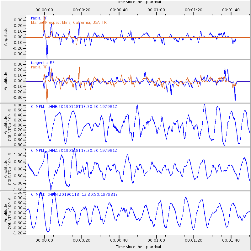
MPM Manuel Prospect Mine, California, USA - Earthquake Result Viewer
*The percent match for this event was below the threshold and hence no stack was calculated.
| Earthquake location: |
Vanuatu Islands |
| Earthquake latitude/longitude: |
-19.2/168.6 |
| Earthquake time(UTC): |
2019/01/18 (018) 13:18:32 GMT |
| Earthquake Depth: |
45 km |
| Earthquake Magnitude: |
6.0 Mww |
| Earthquake Catalog/Contributor: |
NEIC PDE/us |
|
| Network: |
CI Caltech Regional Seismic Network |
| Station: |
MPM Manuel Prospect Mine, California, USA |
| Lat/Lon: |
36.06 N/117.49 W |
| Elevation: |
185 m |
|
| Distance: |
88.8 deg |
| Az: |
51.133 deg |
| Baz: |
245.237 deg |
| Ray Param: |
$rayparam |
*The percent match for this event was below the threshold and hence was not used in the summary stack. |
|
| Radial Match: |
73.07391 % |
| Radial Bump: |
400 |
| Transverse Match: |
41.22214 % |
| Transverse Bump: |
327 |
| SOD ConfigId: |
13570011 |
| Insert Time: |
2019-05-02 07:57:23.547 +0000 |
| GWidth: |
2.5 |
| Max Bumps: |
400 |
| Tol: |
0.001 |
|
Signal To Noise
| Channel | StoN | STA | LTA |
| CI:MPM: :HHZ:20190118T13:30:50.197981Z | 3.154613 | 9.707027E-7 | 3.0770894E-7 |
| CI:MPM: :HHN:20190118T13:30:50.197981Z | 1.8256981 | 7.5930916E-7 | 4.1590073E-7 |
| CI:MPM: :HHE:20190118T13:30:50.197981Z | 0.9246534 | 3.485117E-7 | 3.7691063E-7 |
| Arrivals |
| Ps | |
| PpPs | |
| PsPs/PpSs | |


