You are here: Home > Network List > IW - Intermountain West Stations List
> Station MOOW Moose Ponds, Wyoming, USA > Earthquake Result Viewer
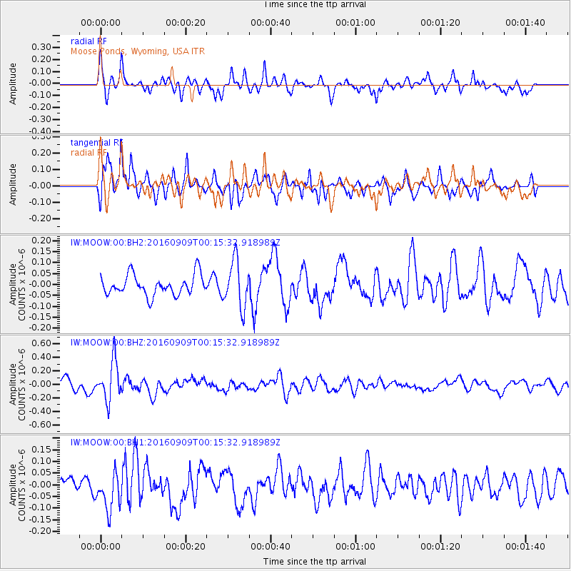
MOOW Moose Ponds, Wyoming, USA - Earthquake Result Viewer
*The percent match for this event was below the threshold and hence no stack was calculated.
| Earthquake location: |
Cordoba Province, Argentina |
| Earthquake latitude/longitude: |
-31.4/-65.7 |
| Earthquake time(UTC): |
2016/09/09 (253) 00:03:43 GMT |
| Earthquake Depth: |
151 km |
| Earthquake Magnitude: |
5.6 MWR |
| Earthquake Catalog/Contributor: |
NEIC PDE/NEIC COMCAT |
|
| Network: |
IW Intermountain West |
| Station: |
MOOW Moose Ponds, Wyoming, USA |
| Lat/Lon: |
43.75 N/110.74 W |
| Elevation: |
2128 m |
|
| Distance: |
85.4 deg |
| Az: |
329.062 deg |
| Baz: |
142.658 deg |
| Ray Param: |
$rayparam |
*The percent match for this event was below the threshold and hence was not used in the summary stack. |
|
| Radial Match: |
62.622784 % |
| Radial Bump: |
400 |
| Transverse Match: |
70.99178 % |
| Transverse Bump: |
400 |
| SOD ConfigId: |
1634031 |
| Insert Time: |
2016-09-23 00:10:55.866 +0000 |
| GWidth: |
2.5 |
| Max Bumps: |
400 |
| Tol: |
0.001 |
|
Signal To Noise
| Channel | StoN | STA | LTA |
| IW:MOOW:00:BHZ:20160909T00:15:32.918989Z | 4.655097 | 2.9630525E-7 | 6.365178E-8 |
| IW:MOOW:00:BH1:20160909T00:15:32.918989Z | 3.317486 | 8.15408E-8 | 2.4579093E-8 |
| IW:MOOW:00:BH2:20160909T00:15:32.918989Z | 2.3330078 | 1.0784088E-7 | 4.622397E-8 |
| Arrivals |
| Ps | |
| PpPs | |
| PsPs/PpSs | |


