You are here: Home > Network List > TA - USArray Transportable Network (new EarthScope stations) Stations List
> Station C24A Savage, MT, USA > Earthquake Result Viewer
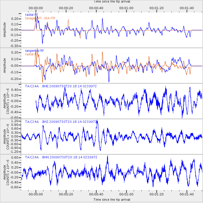
C24A Savage, MT, USA - Earthquake Result Viewer
*The percent match for this event was below the threshold and hence no stack was calculated.
| Earthquake location: |
Tonga Islands |
| Earthquake latitude/longitude: |
-20.8/-174.3 |
| Earthquake time(UTC): |
2009/07/30 (211) 20:05:34 GMT |
| Earthquake Depth: |
10 km |
| Earthquake Magnitude: |
5.9 MB, 5.7 MS, 5.8 MW, 5.7 MW |
| Earthquake Catalog/Contributor: |
WHDF/NEIC |
|
| Network: |
TA USArray Transportable Network (new EarthScope stations) |
| Station: |
C24A Savage, MT, USA |
| Lat/Lon: |
47.53 N/104.43 W |
| Elevation: |
713 m |
|
| Distance: |
92.4 deg |
| Az: |
39.542 deg |
| Baz: |
241.487 deg |
| Ray Param: |
$rayparam |
*The percent match for this event was below the threshold and hence was not used in the summary stack. |
|
| Radial Match: |
69.69925 % |
| Radial Bump: |
400 |
| Transverse Match: |
66.63638 % |
| Transverse Bump: |
400 |
| SOD ConfigId: |
2622 |
| Insert Time: |
2010-03-06 19:26:06.416 +0000 |
| GWidth: |
2.5 |
| Max Bumps: |
400 |
| Tol: |
0.001 |
|
Signal To Noise
| Channel | StoN | STA | LTA |
| TA:C24A: :BHZ:20090730T20:18:14.023997Z | 2.975169 | 4.1263183E-7 | 1.3869189E-7 |
| TA:C24A: :BHN:20090730T20:18:14.023997Z | 0.614633 | 9.7725156E-8 | 1.5899758E-7 |
| TA:C24A: :BHE:20090730T20:18:14.023997Z | 1.2494353 | 2.1057286E-7 | 1.6853441E-7 |
| Arrivals |
| Ps | |
| PpPs | |
| PsPs/PpSs | |


