You are here: Home > Network List > TA - USArray Transportable Network (new EarthScope stations) Stations List
> Station C24A Savage, MT, USA > Earthquake Result Viewer
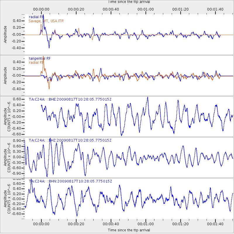
C24A Savage, MT, USA - Earthquake Result Viewer
*The percent match for this event was below the threshold and hence no stack was calculated.
| Earthquake location: |
Southwestern Ryukyu Isl., Japan |
| Earthquake latitude/longitude: |
23.4/123.7 |
| Earthquake time(UTC): |
2009/08/17 (229) 10:15:05 GMT |
| Earthquake Depth: |
10 km |
| Earthquake Magnitude: |
5.7 MB |
| Earthquake Catalog/Contributor: |
WHDF/NEIC |
|
| Network: |
TA USArray Transportable Network (new EarthScope stations) |
| Station: |
C24A Savage, MT, USA |
| Lat/Lon: |
47.53 N/104.43 W |
| Elevation: |
713 m |
|
| Distance: |
97.2 deg |
| Az: |
30.575 deg |
| Baz: |
316.409 deg |
| Ray Param: |
$rayparam |
*The percent match for this event was below the threshold and hence was not used in the summary stack. |
|
| Radial Match: |
84.240974 % |
| Radial Bump: |
389 |
| Transverse Match: |
55.775837 % |
| Transverse Bump: |
400 |
| SOD ConfigId: |
2622 |
| Insert Time: |
2010-03-06 19:26:17.411 +0000 |
| GWidth: |
2.5 |
| Max Bumps: |
400 |
| Tol: |
0.001 |
|
Signal To Noise
| Channel | StoN | STA | LTA |
| TA:C24A: :BHZ:20090817T10:28:05.775015Z | 1.5053309 | 5.5070575E-7 | 3.65837E-7 |
| TA:C24A: :BHN:20090817T10:28:05.775015Z | 1.1331022 | 2.8176242E-7 | 2.486646E-7 |
| TA:C24A: :BHE:20090817T10:28:05.775015Z | 1.0532379 | 2.3275464E-7 | 2.2098962E-7 |
| Arrivals |
| Ps | |
| PpPs | |
| PsPs/PpSs | |


