You are here: Home > Network List > TA - USArray Transportable Network (new EarthScope stations) Stations List
> Station C24A Savage, MT, USA > Earthquake Result Viewer
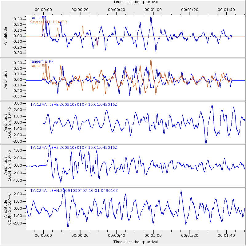
C24A Savage, MT, USA - Earthquake Result Viewer
*The percent match for this event was below the threshold and hence no stack was calculated.
| Earthquake location: |
Ryukyu Islands, Japan |
| Earthquake latitude/longitude: |
29.2/129.8 |
| Earthquake time(UTC): |
2009/10/30 (303) 07:03:39 GMT |
| Earthquake Depth: |
34 km |
| Earthquake Magnitude: |
6.3 MB, 6.8 MS, 6.8 MW, 6.8 MW |
| Earthquake Catalog/Contributor: |
WHDF/NEIC |
|
| Network: |
TA USArray Transportable Network (new EarthScope stations) |
| Station: |
C24A Savage, MT, USA |
| Lat/Lon: |
47.53 N/104.43 W |
| Elevation: |
713 m |
|
| Distance: |
89.4 deg |
| Az: |
33.347 deg |
| Baz: |
314.838 deg |
| Ray Param: |
$rayparam |
*The percent match for this event was below the threshold and hence was not used in the summary stack. |
|
| Radial Match: |
75.05331 % |
| Radial Bump: |
400 |
| Transverse Match: |
76.51324 % |
| Transverse Bump: |
317 |
| SOD ConfigId: |
2622 |
| Insert Time: |
2010-03-06 19:26:33.968 +0000 |
| GWidth: |
2.5 |
| Max Bumps: |
400 |
| Tol: |
0.001 |
|
Signal To Noise
| Channel | StoN | STA | LTA |
| TA:C24A: :BHZ:20091030T07:16:01.049016Z | 8.025343 | 2.308584E-6 | 2.8766172E-7 |
| TA:C24A: :BHN:20091030T07:16:01.049016Z | 1.2459509 | 5.260791E-7 | 4.2223095E-7 |
| TA:C24A: :BHE:20091030T07:16:01.049016Z | 1.4610939 | 9.422209E-7 | 6.448736E-7 |
| Arrivals |
| Ps | |
| PpPs | |
| PsPs/PpSs | |


