You are here: Home > Network List > TA - USArray Transportable Network (new EarthScope stations) Stations List
> Station C24A Savage, MT, USA > Earthquake Result Viewer
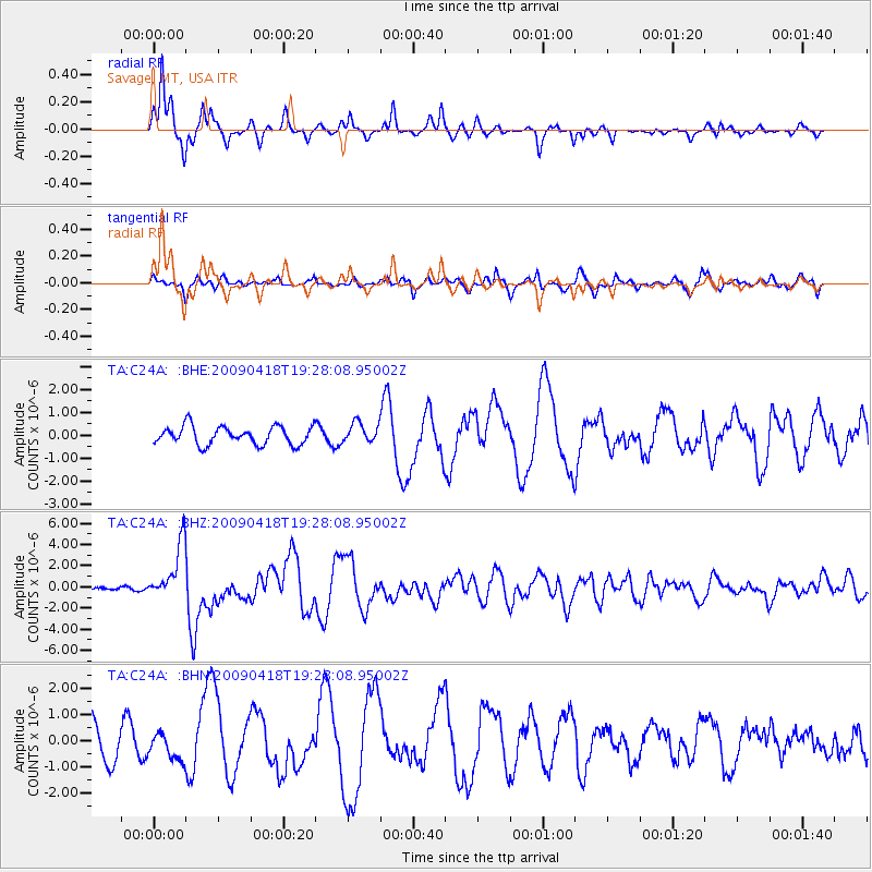
C24A Savage, MT, USA - Earthquake Result Viewer
*The percent match for this event was below the threshold and hence no stack was calculated.
| Earthquake location: |
Kuril Islands |
| Earthquake latitude/longitude: |
46.0/151.4 |
| Earthquake time(UTC): |
2009/04/18 (108) 19:17:58 GMT |
| Earthquake Depth: |
35 km |
| Earthquake Magnitude: |
6.3 MB, 6.3 MS, 6.6 MW, 6.4 MW |
| Earthquake Catalog/Contributor: |
WHDF/NEIC |
|
| Network: |
TA USArray Transportable Network (new EarthScope stations) |
| Station: |
C24A Savage, MT, USA |
| Lat/Lon: |
47.53 N/104.43 W |
| Elevation: |
713 m |
|
| Distance: |
65.7 deg |
| Az: |
46.15 deg |
| Baz: |
312.132 deg |
| Ray Param: |
$rayparam |
*The percent match for this event was below the threshold and hence was not used in the summary stack. |
|
| Radial Match: |
92.33824 % |
| Radial Bump: |
295 |
| Transverse Match: |
62.779503 % |
| Transverse Bump: |
400 |
| SOD ConfigId: |
2658 |
| Insert Time: |
2010-03-06 19:26:48.143 +0000 |
| GWidth: |
2.5 |
| Max Bumps: |
400 |
| Tol: |
0.001 |
|
Signal To Noise
| Channel | StoN | STA | LTA |
| TA:C24A: :BHZ:20090418T19:28:08.95002Z | 13.493698 | 2.671375E-6 | 1.9797203E-7 |
| TA:C24A: :BHN:20090418T19:28:08.95002Z | 0.92400706 | 4.947469E-7 | 5.3543624E-7 |
| TA:C24A: :BHE:20090418T19:28:08.95002Z | 1.0962449 | 4.3249506E-7 | 3.9452414E-7 |
| Arrivals |
| Ps | |
| PpPs | |
| PsPs/PpSs | |


