You are here: Home > Network List > TA - USArray Transportable Network (new EarthScope stations) Stations List
> Station C24A Savage, MT, USA > Earthquake Result Viewer
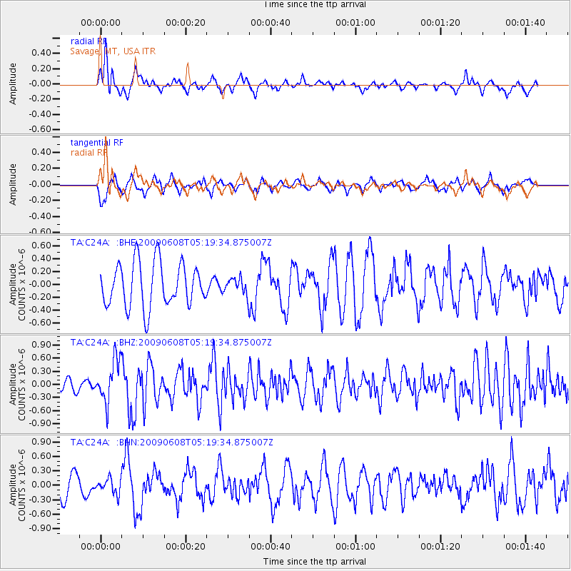
C24A Savage, MT, USA - Earthquake Result Viewer
*The percent match for this event was below the threshold and hence no stack was calculated.
| Earthquake location: |
Honduras |
| Earthquake latitude/longitude: |
15.8/-86.9 |
| Earthquake time(UTC): |
2009/06/08 (159) 05:13:14 GMT |
| Earthquake Depth: |
10 km |
| Earthquake Magnitude: |
5.5 MB, 4.9 MS, 5.4 MW, 5.4 MW |
| Earthquake Catalog/Contributor: |
WHDF/NEIC |
|
| Network: |
TA USArray Transportable Network (new EarthScope stations) |
| Station: |
C24A Savage, MT, USA |
| Lat/Lon: |
47.53 N/104.43 W |
| Elevation: |
713 m |
|
| Distance: |
34.8 deg |
| Az: |
339.021 deg |
| Baz: |
149.428 deg |
| Ray Param: |
$rayparam |
*The percent match for this event was below the threshold and hence was not used in the summary stack. |
|
| Radial Match: |
64.78978 % |
| Radial Bump: |
394 |
| Transverse Match: |
46.292847 % |
| Transverse Bump: |
381 |
| SOD ConfigId: |
2648 |
| Insert Time: |
2010-03-06 19:26:50.193 +0000 |
| GWidth: |
2.5 |
| Max Bumps: |
400 |
| Tol: |
0.001 |
|
Signal To Noise
| Channel | StoN | STA | LTA |
| TA:C24A: :BHZ:20090608T05:19:34.875007Z | 2.6293726 | 5.0400035E-7 | 1.9168084E-7 |
| TA:C24A: :BHN:20090608T05:19:34.875007Z | 0.86896086 | 1.5731574E-7 | 1.8103893E-7 |
| TA:C24A: :BHE:20090608T05:19:34.875007Z | 0.3723355 | 1.2763952E-7 | 3.4280785E-7 |
| Arrivals |
| Ps | |
| PpPs | |
| PsPs/PpSs | |


