You are here: Home > Network List > TA - USArray Transportable Network (new EarthScope stations) Stations List
> Station C24A Savage, MT, USA > Earthquake Result Viewer
C24A Savage, MT, USA - Earthquake Result Viewer
*The percent match for this event was below the threshold and hence no stack was calculated.
| Earthquake location: |
Tonga Islands Region |
| Earthquake latitude/longitude: |
-23.0/-174.7 |
| Earthquake time(UTC): |
2009/03/19 (078) 18:17:40 GMT |
| Earthquake Depth: |
34 km |
| Earthquake Magnitude: |
7.0 MB, 7.6 MS, 7.6 MW, 7.6 MW |
| Earthquake Catalog/Contributor: |
WHDF/NEIC |
|
| Network: |
TA USArray Transportable Network (new EarthScope stations) |
| Station: |
C24A Savage, MT, USA |
| Lat/Lon: |
47.53 N/104.43 W |
| Elevation: |
713 m |
|
| Distance: |
94.3 deg |
| Az: |
39.758 deg |
| Baz: |
240.379 deg |
| Ray Param: |
$rayparam |
*The percent match for this event was below the threshold and hence was not used in the summary stack. |
|
| Radial Match: |
97.582375 % |
| Radial Bump: |
399 |
| Transverse Match: |
90.801605 % |
| Transverse Bump: |
400 |
| SOD ConfigId: |
2658 |
| Insert Time: |
2010-03-06 19:27:05.635 +0000 |
| GWidth: |
2.5 |
| Max Bumps: |
400 |
| Tol: |
0.001 |
|
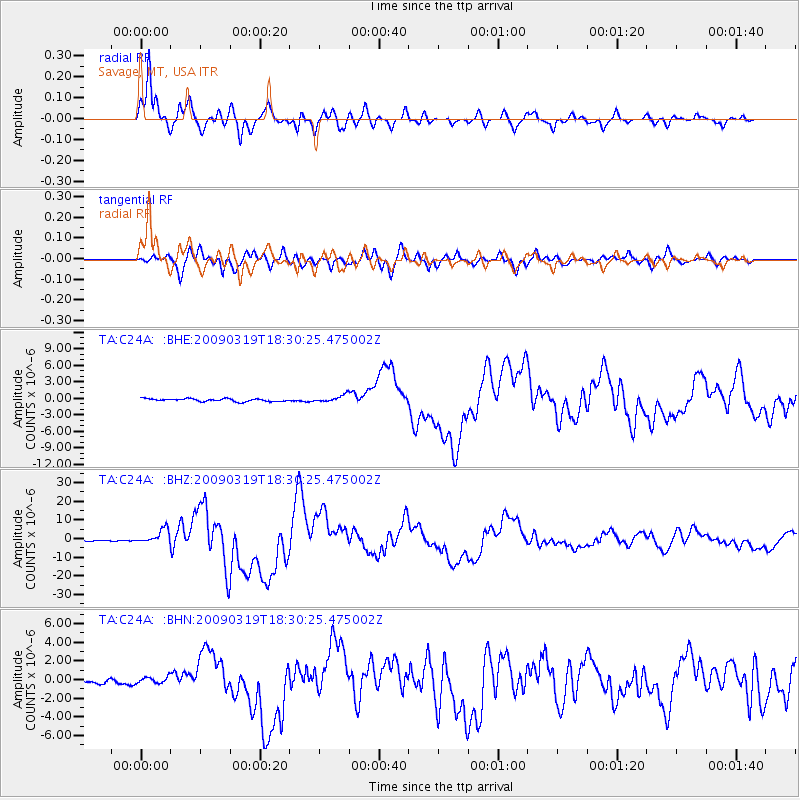
Signal To Noise
| Channel | StoN | STA | LTA |
| TA:C24A: :BHZ:20090319T18:30:25.475002Z | 20.41185 | 3.88666E-6 | 1.9041195E-7 |
| TA:C24A: :BHN:20090319T18:30:25.475002Z | 0.96891564 | 3.463646E-7 | 3.5747652E-7 |
| TA:C24A: :BHE:20090319T18:30:25.475002Z | 2.6489947 | 6.4652414E-7 | 2.4406395E-7 |
| Arrivals |
| Ps | |
| PpPs | |
| PsPs/PpSs | |


