You are here: Home > Network List > TA - USArray Transportable Network (new EarthScope stations) Stations List
> Station C24A Savage, MT, USA > Earthquake Result Viewer
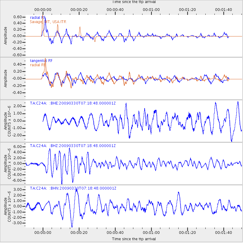
C24A Savage, MT, USA - Earthquake Result Viewer
*The percent match for this event was below the threshold and hence no stack was calculated.
| Earthquake location: |
Kodiak Island Region, Alaska |
| Earthquake latitude/longitude: |
56.5/-152.7 |
| Earthquake time(UTC): |
2009/03/30 (089) 07:13:07 GMT |
| Earthquake Depth: |
21 km |
| Earthquake Magnitude: |
5.9 MB, 5.9 MS, 5.9 MW, 5.9 MW |
| Earthquake Catalog/Contributor: |
WHDF/NEIC |
|
| Network: |
TA USArray Transportable Network (new EarthScope stations) |
| Station: |
C24A Savage, MT, USA |
| Lat/Lon: |
47.53 N/104.43 W |
| Elevation: |
713 m |
|
| Distance: |
30.5 deg |
| Az: |
86.375 deg |
| Baz: |
305.348 deg |
| Ray Param: |
$rayparam |
*The percent match for this event was below the threshold and hence was not used in the summary stack. |
|
| Radial Match: |
86.14547 % |
| Radial Bump: |
400 |
| Transverse Match: |
63.98338 % |
| Transverse Bump: |
400 |
| SOD ConfigId: |
2658 |
| Insert Time: |
2010-03-06 19:27:18.255 +0000 |
| GWidth: |
2.5 |
| Max Bumps: |
400 |
| Tol: |
0.001 |
|
Signal To Noise
| Channel | StoN | STA | LTA |
| TA:C24A: :BHZ:20090330T07:18:48.000001Z | 7.0649943 | 2.5183474E-6 | 3.5645425E-7 |
| TA:C24A: :BHN:20090330T07:18:48.000001Z | 1.5183257 | 6.289578E-7 | 4.1424434E-7 |
| TA:C24A: :BHE:20090330T07:18:48.000001Z | 1.6036955 | 7.670151E-7 | 4.7827973E-7 |
| Arrivals |
| Ps | |
| PpPs | |
| PsPs/PpSs | |


