You are here: Home > Network List > TA - USArray Transportable Network (new EarthScope stations) Stations List
> Station C24A Savage, MT, USA > Earthquake Result Viewer
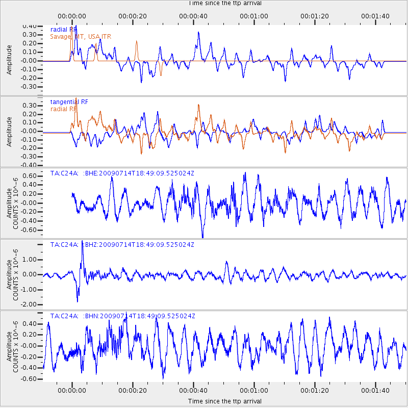
C24A Savage, MT, USA - Earthquake Result Viewer
*The percent match for this event was below the threshold and hence no stack was calculated.
| Earthquake location: |
Chile-Bolivia Border Region |
| Earthquake latitude/longitude: |
-21.8/-67.1 |
| Earthquake time(UTC): |
2009/07/14 (195) 18:38:08 GMT |
| Earthquake Depth: |
176 km |
| Earthquake Magnitude: |
5.7 MW, 5.4 MB, 5.7 MW |
| Earthquake Catalog/Contributor: |
WHDF/NEIC |
|
| Network: |
TA USArray Transportable Network (new EarthScope stations) |
| Station: |
C24A Savage, MT, USA |
| Lat/Lon: |
47.53 N/104.43 W |
| Elevation: |
713 m |
|
| Distance: |
76.8 deg |
| Az: |
335.025 deg |
| Baz: |
144.624 deg |
| Ray Param: |
$rayparam |
*The percent match for this event was below the threshold and hence was not used in the summary stack. |
|
| Radial Match: |
54.54689 % |
| Radial Bump: |
400 |
| Transverse Match: |
63.32119 % |
| Transverse Bump: |
400 |
| SOD ConfigId: |
2648 |
| Insert Time: |
2010-03-06 19:27:19.243 +0000 |
| GWidth: |
2.5 |
| Max Bumps: |
400 |
| Tol: |
0.001 |
|
Signal To Noise
| Channel | StoN | STA | LTA |
| TA:C24A: :BHZ:20090714T18:49:09.525024Z | 7.6975474 | 8.5225327E-7 | 1.1071751E-7 |
| TA:C24A: :BHN:20090714T18:49:09.525024Z | 0.82651305 | 2.0571753E-7 | 2.488981E-7 |
| TA:C24A: :BHE:20090714T18:49:09.525024Z | 1.3426138 | 2.4672445E-7 | 1.8376427E-7 |
| Arrivals |
| Ps | |
| PpPs | |
| PsPs/PpSs | |


