BRSD Miller, SD, USA - Earthquake Result Viewer
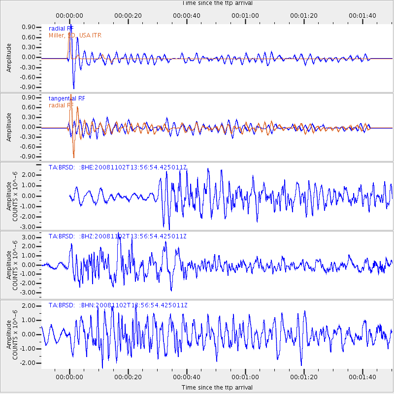
Earthquake location: Andreanof Islands, Aleutian Is.
Earthquake latitude/longitude: 51.6/-174.4
Earthquake time(UTC): 2008/11/02 (307) 13:48:42 GMT
Earthquake Depth: 36 km
Earthquake Magnitude: 5.7 MB, 5.8 MS, 6.1 MW, 6.1 MW
Earthquake Catalog/Contributor: WHDF/NEIC
Network: TA USArray Transportable Network (new EarthScope stations)
Station: BRSD Miller, SD, USA
Lat/Lon: 44.44 N/98.96 W
Elevation: 519 m
Distance: 48.9 deg
Az: 66.966 deg
Baz: 306.663 deg
Ray Param: 0.06899525
Estimated Moho Depth: 50.75 km
Estimated Crust Vp/Vs: 1.64
Assumed Crust Vp: 6.53 km/s
Estimated Crust Vs: 3.988 km/s
Estimated Crust Poisson's Ratio: 0.20
Radial Match: 84.28313 %
Radial Bump: 400
Transverse Match: 71.248924 %
Transverse Bump: 400
SOD ConfigId: 2658
Insert Time: 2010-03-06 19:27:45.964 +0000
GWidth: 2.5
Max Bumps: 400
Tol: 0.001

Signal To Noise

ChannelStoNSTALTA
TA:BRSD: :BHZ:20081102T13:56:54.425011Z3.97825431.2551203E-63.1549524E-7
TA:BRSD: :BHN:20081102T13:56:54.425011Z1.6007987.7692573E-74.853365E-7
TA:BRSD: :BHE:20081102T13:56:54.425011Z3.90817621.4726018E-63.7680024E-7
Arrivals
Ps5.3 SECOND
PpPs19 SECOND
PsPs/PpSs24 SECOND