BRSD Miller, SD, USA - Earthquake Result Viewer
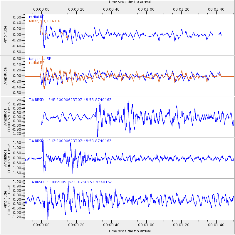
Earthquake location: Near East Coast Of Honshu, Japan
Earthquake latitude/longitude: 38.8/142.4
Earthquake time(UTC): 2009/06/23 (174) 07:37:17 GMT
Earthquake Depth: 37 km
Earthquake Magnitude: 5.7 MB, 5.0 MS, 5.6 MW, 5.6 MW
Earthquake Catalog/Contributor: WHDF/NEIC
Network: TA USArray Transportable Network (new EarthScope stations)
Station: BRSD Miller, SD, USA
Lat/Lon: 44.44 N/98.96 W
Elevation: 519 m
Distance: 80.3 deg
Az: 39.613 deg
Baz: 315.968 deg
Ray Param: 0.04828634
Estimated Moho Depth: 37.0 km
Estimated Crust Vp/Vs: 1.99
Assumed Crust Vp: 6.53 km/s
Estimated Crust Vs: 3.282 km/s
Estimated Crust Poisson's Ratio: 0.33
Radial Match: 84.4948 %
Radial Bump: 400
Transverse Match: 72.06494 %
Transverse Bump: 400
SOD ConfigId: 2648
Insert Time: 2010-03-06 19:28:37.521 +0000
GWidth: 2.5
Max Bumps: 400
Tol: 0.001

Signal To Noise

ChannelStoNSTALTA
TA:BRSD: :BHZ:20090623T07:48:53.874016Z8.3643367.081113E-78.4658396E-8
TA:BRSD: :BHN:20090623T07:48:53.874016Z2.69632945.3400237E-71.980479E-7
TA:BRSD: :BHE:20090623T07:48:53.874016Z3.08453855.5739434E-71.8070592E-7
Arrivals
Ps5.8 SECOND
PpPs17 SECOND
PsPs/PpSs22 SECOND