BRSD Miller, SD, USA - Earthquake Result Viewer
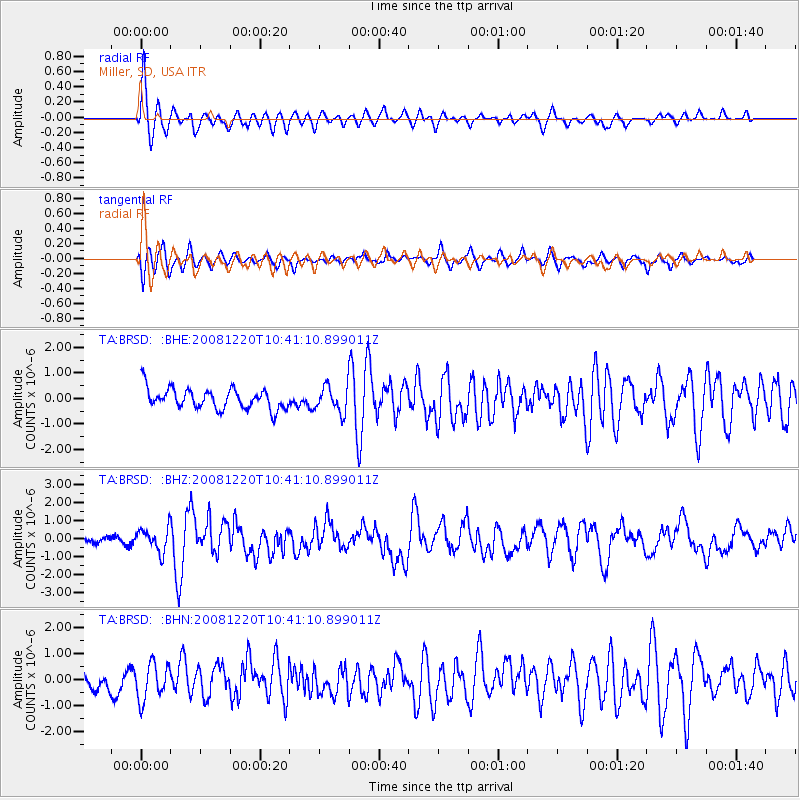
Earthquake location: Off East Coast Of Honshu, Japan
Earthquake latitude/longitude: 36.5/142.4
Earthquake time(UTC): 2008/12/20 (355) 10:29:23 GMT
Earthquake Depth: 19 km
Earthquake Magnitude: 6.0 MB, 6.3 MS, 6.3 MW, 6.3 MW
Earthquake Catalog/Contributor: WHDF/NEIC
Network: TA USArray Transportable Network (new EarthScope stations)
Station: BRSD Miller, SD, USA
Lat/Lon: 44.44 N/98.96 W
Elevation: 519 m
Distance: 82.1 deg
Az: 39.405 deg
Baz: 314.462 deg
Ray Param: 0.04710226
Estimated Moho Depth: 46.25 km
Estimated Crust Vp/Vs: 1.76
Assumed Crust Vp: 6.53 km/s
Estimated Crust Vs: 3.71 km/s
Estimated Crust Poisson's Ratio: 0.26
Radial Match: 84.75205 %
Radial Bump: 375
Transverse Match: 57.139343 %
Transverse Bump: 400
SOD ConfigId: 2658
Insert Time: 2010-03-06 19:28:41.477 +0000
GWidth: 2.5
Max Bumps: 400
Tol: 0.001

Signal To Noise

ChannelStoNSTALTA
TA:BRSD: :BHZ:20081220T10:41:10.899011Z2.58024886.5384796E-72.53405E-7
TA:BRSD: :BHN:20081220T10:41:10.899011Z2.1819186.9053624E-73.1648133E-7
TA:BRSD: :BHE:20081220T10:41:10.899011Z1.29365385.1571806E-73.9865228E-7
Arrivals
Ps5.5 SECOND
PpPs19 SECOND
PsPs/PpSs25 SECOND