
BRSD Miller, SD, USA - Earthquake Result Viewer
| ||||||||||||||||||
| ||||||||||||||||||
| ||||||||||||||||||
|
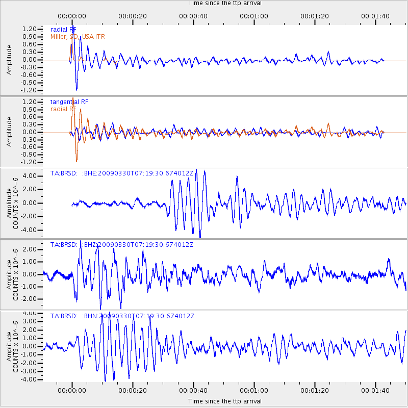
Signal To Noise
| Channel | StoN | STA | LTA |
| TA:BRSD: :BHZ:20090330T07:19:30.674012Z | 6.662803 | 1.1542065E-6 | 1.7323137E-7 |
| TA:BRSD: :BHN:20090330T07:19:30.674012Z | 4.0926456 | 1.243175E-6 | 3.0375827E-7 |
| TA:BRSD: :BHE:20090330T07:19:30.674012Z | 6.6594505 | 1.8650544E-6 | 2.800613E-7 |
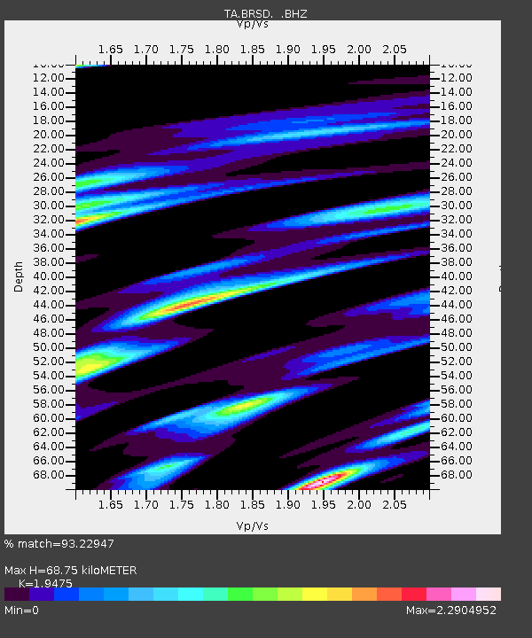
| Arrivals | |
| Ps | 11 SECOND |
| PpPs | 29 SECOND |
| PsPs/PpSs | 40 SECOND |

