
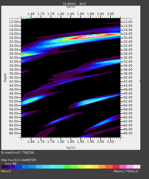
BRSD Miller, SD, USA - Earthquake Result Viewer
| ||||||||||||||||||
| ||||||||||||||||||
| ||||||||||||||||||
|
Signal To Noise
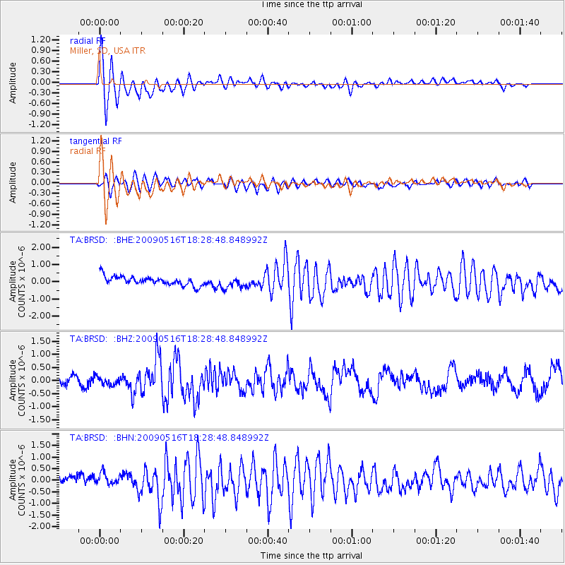
| Channel | StoN | STA | LTA |
| TA:BRSD: :BHZ:20090516T18:28:48.848992Z | 0.7383232 | 1.4930296E-7 | 2.0221897E-7 |
| TA:BRSD: :BHN:20090516T18:28:48.848992Z | 0.8934138 | 2.71413E-7 | 3.0379317E-7 |
| TA:BRSD: :BHE:20090516T18:28:48.848992Z | 1.3459135 | 3.4549487E-7 | 2.5669917E-7 |
| Arrivals | |
| Ps | 3.0 SECOND |
| PpPs | 8.0 SECOND |
| PsPs/PpSs | 11 SECOND |

