You are here: Home > Network List > TA - USArray Transportable Network (new EarthScope stations) Stations List
> Station BRSD Miller, SD, USA > Earthquake Result Viewer
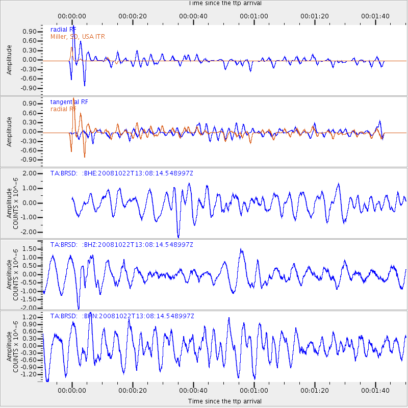
BRSD Miller, SD, USA - Earthquake Result Viewer
*The percent match for this event was below the threshold and hence no stack was calculated.
| Earthquake location: |
Tonga Islands |
| Earthquake latitude/longitude: |
-18.4/-175.4 |
| Earthquake time(UTC): |
2008/10/22 (296) 12:55:57 GMT |
| Earthquake Depth: |
233 km |
| Earthquake Magnitude: |
5.9 MB, 6.4 MW, 6.3 MW |
| Earthquake Catalog/Contributor: |
WHDF/NEIC |
|
| Network: |
TA USArray Transportable Network (new EarthScope stations) |
| Station: |
BRSD Miller, SD, USA |
| Lat/Lon: |
44.44 N/98.96 W |
| Elevation: |
519 m |
|
| Distance: |
93.4 deg |
| Az: |
44.22 deg |
| Baz: |
247.579 deg |
| Ray Param: |
$rayparam |
*The percent match for this event was below the threshold and hence was not used in the summary stack. |
|
| Radial Match: |
72.33071 % |
| Radial Bump: |
400 |
| Transverse Match: |
49.176556 % |
| Transverse Bump: |
400 |
| SOD ConfigId: |
2560 |
| Insert Time: |
2010-03-06 19:29:11.078 +0000 |
| GWidth: |
2.5 |
| Max Bumps: |
400 |
| Tol: |
0.001 |
|
Signal To Noise
| Channel | StoN | STA | LTA |
| TA:BRSD: :BHZ:20081022T13:08:14.548997Z | 1.894972 | 9.1551203E-7 | 4.83127E-7 |
| TA:BRSD: :BHN:20081022T13:08:14.548997Z | 0.8058789 | 5.904083E-7 | 7.326266E-7 |
| TA:BRSD: :BHE:20081022T13:08:14.548997Z | 1.3984091 | 7.072601E-7 | 5.0576045E-7 |
| Arrivals |
| Ps | |
| PpPs | |
| PsPs/PpSs | |


