You are here: Home > Network List > TA - USArray Transportable Network (new EarthScope stations) Stations List
> Station BRSD Miller, SD, USA > Earthquake Result Viewer
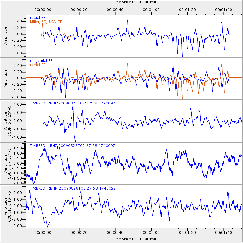
BRSD Miller, SD, USA - Earthquake Result Viewer
*The percent match for this event was below the threshold and hence no stack was calculated.
| Earthquake location: |
Qinghai, China |
| Earthquake latitude/longitude: |
37.6/95.7 |
| Earthquake time(UTC): |
2009/08/28 (240) 02:14:56 GMT |
| Earthquake Depth: |
4.0 km |
| Earthquake Magnitude: |
5.6 MB |
| Earthquake Catalog/Contributor: |
WHDF/NEIC |
|
| Network: |
TA USArray Transportable Network (new EarthScope stations) |
| Station: |
BRSD Miller, SD, USA |
| Lat/Lon: |
44.44 N/98.96 W |
| Elevation: |
519 m |
|
| Distance: |
97.2 deg |
| Az: |
10.533 deg |
| Baz: |
348.313 deg |
| Ray Param: |
$rayparam |
*The percent match for this event was below the threshold and hence was not used in the summary stack. |
|
| Radial Match: |
35.011063 % |
| Radial Bump: |
400 |
| Transverse Match: |
43.551964 % |
| Transverse Bump: |
400 |
| SOD ConfigId: |
2622 |
| Insert Time: |
2010-03-06 19:29:16.838 +0000 |
| GWidth: |
2.5 |
| Max Bumps: |
400 |
| Tol: |
0.001 |
|
Signal To Noise
| Channel | StoN | STA | LTA |
| TA:BRSD: :BHZ:20090828T02:27:58.174009Z | 1.113145 | 1.0352788E-6 | 9.300485E-7 |
| TA:BRSD: :BHN:20090828T02:27:58.174009Z | 1.7266711 | 2.206841E-6 | 1.2780899E-6 |
| TA:BRSD: :BHE:20090828T02:27:58.174009Z | 1.3372828 | 1.8863424E-6 | 1.4105785E-6 |
| Arrivals |
| Ps | |
| PpPs | |
| PsPs/PpSs | |


